Expedition Cordillera Blanca

Peru, July - August 2025

An expedition to the Cordillera Blanca had been a dream project of mine for years. When I first traveled to Peru in 2021, I had very little mountaineering experience, it was the rainy season, and I was traveling alone — not exactly ideal conditions for climbing high mountains. So I stayed on the trekking routes in the valleys, but I was already fascinated by the peaks of the Cordillera Blanca. When I left Huaraz in November 2021, I was already dreaming of returning to climb mountains like Alpamayo or Huascarán one day.

By the end of 2024, it finally began to look like that dream might become reality. Luca, a fellow alpinist from Switzerland I had met on an expedition in Kyrgyzstan, seemed just as motivated as I was to head to Peru. We slowly began gathering ideas about how we could turn such a project into reality. Over the following months, the plans became more concrete, and suddenly the day arrived when we booked our flights — and it was officially confirmed that I would finally return to Peru.

Days 1–4

At the beginning of July, we finally landed in Lima. Unfortunately, only part of our luggage made it to the Peruvian capital with us, but even so, we had more than enough to carry. The first taxi ride from the airport was almost a little emotional for me. So many wonderful memories from my 13-month journey through Latin America came up, and I was so happy to be back in South America.

After one day of sightseeing in Lima, the last duffel bag finally arrived, and we carried around 160 kilograms of gear, food, and clothing to the Terminal Plaza Norte, from where we embarked on a ten-hour bus ride to Huaraz. Once again, it was a very familiar route through the desert, along the coast, and finally into the mountains at sunset. We arrived in Huaraz in the middle of the night and headed straight to the “Big Mountain Hostel,” which would serve as our base for the coming weeks.

The next morning, I could hardly believe I was walking in the streets of Huaraz again, eating an almuerzo at the Mercado Central, and already catching the first views of the glaciers of the Cordillera Blanca. Arti, the owner of the hostel, gave us a warm welcome, and the first day was mainly spent doing errands and settling in.

Days 5–7

On the second day after arriving in Huaraz, we began with the acclimatization phase. Especially because of the incident during the Khan Tengri expedition, it was important to me to take this phase slowly and place great emphasis on proper acclimatization. So we started with three relaxed hikes: first to Laguna Churup at 4,450 meters, located close to Huaraz; then to the beautiful Laguna Parón at 4,200 meters; and on the third acclimatization day to Laguna 69 at around 4,600 meters. Although these tours were unfortunately quite touristy, we had wonderful days with incredibly blue lakes and fantastic views of some of the high peaks of the Cordillera Blanca. These hikes also brought back beautiful memories, as I had done all three of them four years earlier already.

Days 8–14

After a rest day in Huaraz, it was time to climb above 5,000 meters for the first time. For that, we chose Nevado Ulta Chico as our first acclimatization peak. At 2 a.m., we set off by taxi from Huaraz towards Punta Olímpica, one of the few mountain passes in the Cordillera Blanca with a road crossing it. I tried to get some sleep, but the endless curves oft he road made that nearly impossible. To make matters worse, our taxi driver occasionally attempted shortcuts along small, steep, and extremely narrow roads, where the car repeatedly scraped the ground and brushed against rocks at tight sections. Not the best conditions to sleep.

Around 4 a.m., we arrived at the starting point of our tour at 4,700 meters. It was bitterly cold, and I was glad when we finally started moving. In the darkness, we searched for a route through steep terrain towards the glacier, which we reached at first daylight. During a beautiful sunrise, we crossed a relatively flat glacier until we stood almost directly below the summit. Over a steep section (about two rope lengths, up to around 70 degrees at the top), which we climbed simultaneously, we reached the ridge. From there, it remained steep but short to the summit at approximately 5,350 meters. In perfect weather, we spent about half an hour in the sun, enjoying views to several 6,000-meter peaks around us. Then we startet the descent. After two rappels, we descended quickly along the ascent route. By the afternoon, we were already back in Huaraz, happy to have reached our first small summit.

Two more days in the city followed, spent resting, eating, and doing further errands, like buying radios and getting more snow anchors, which were good and not expensive in Huaraz.

The next acclimatization tour would also be our first multi-day tour. Our objective was Huaraz’s “local mountain,” Vallunaraju. At a relaxed time in the late morning, we once again took a taxi into the mountains. We followed a gravel road, which felt endless, through the Llaca Valley to the Refugio Llaca. From there, we continued on foot. Along a sometimes steep trail with breathtaking views of Ranrapalca and the Laguna Llaca below, we climbed about 650 vertical meters with heavy backpacks to Moraine Camp at 4,950 meters.

Vallunaraju is a technically easy mountain directly above Huaraz and is therefore climbed frequently. As a result, there were already a few small flat areas free of rocks and vegetation where we could pitch our tent easily. Once that was done, we continued without backpacks to the glacier’s edge above 5,000 meters. There we found two small lakes which was a beautiful spot where we spent the afternoon lying on flat rocks in the sun. Back at camp, we had to sort out our water supply. There was no real running water. However, in a small trickle among the rocks, ice had formed. We chopped out a block with our ice axes and melted it right next to the tent.

The next day, we set off around 3:30 a.m. After a short approach to the glacier, we chose a more direct and steeper route, than the normal route, we had scoped out the day before. We gained elevation quickly before rejoining the normal route and continuing toward the summit. Behind us in the valley, we could see the lights of Huaraz – a beautiful sight. At first daylight, we were on the summit ridge of the north peak, and just a few minutes before sunrise, we stood on the summit of Vallunaraju Norte (5,686 m). It was extremely cold and windy, but wrapped in my thick down jacket it was okay, and we were rewarded with a beautiful sunrise overlooking Huaraz and large parts of the Cordillera Blanca.

On the descent, we made a short detour to the south summit of Vallunaraju (Vallunaraju Sur – 5,605 m) before descending without difficulty along the ascent route. At first back to Moraine Camp and then down into the Llaca Valley.

Days 15–21

Day 15 was entirely dedicated to organization. We were planning to head into the Ishinca Valley for a few days and still had quite a bit to prepare. Maycol, who runs a shop in the same building as our hostel, gave me Cirilo’s number. Cirilo was a local who lived in the mountain village from which we would start our approach into the valley. He was an Arriero, which means he owned several horses and donkeys that could help us transport our gear to base camp. I called him, and luckily he was available the very next day. We arranged to head up to base camp together. Benni from Switzerland and Luca from Germany, whom we had met at the hostel a few days earlier, also decided to join us.

Detailed report about Tocllaraju and the Ishinca Valley can be found here.

The next day, Cirilo picked us up in Huaraz and we drove to Pashpa. In the fields behind the small mountain village, we loaded our equipment onto two horses and two donkeys. This allowed us to bring plenty of food — and not just freeze-dried meals — as well as a bit of extra comfort, such as spare clothes for base camp. As we set off, it was a special moment for me. Before the expedition, I had imagined it exactly like this: hiking through the Peruvian Andes in a small caravan with donkeys, heading off to climb mountains.

The hike to base camp was beautiful. First, we crossed open terrain with spectacular views of Copa and Huascarán before entering the Ishinca Valley. In this deep valley, a varied trail awaited us: through forests, across meadows, and sometimes along the river. Eventually, we caught a first sight of Palcaraju Oeste, and shortly afterward of Tocllaraju as well, which was our main objective for the coming days. After about 850 meters of elevation gain and 11 kilometers of hiking, we reached Ishinca Base Camp at around 4,350 meters. We pitched our tent on a meadow between a small river and some rocks — truly a beautiful base camp.

The next day, Luca and I set off for Tocllaraju High Camp. Benni and Luca planned to climb Nevado Ishinca and Nevado Urus Este for acclimatization, so they didn’t join us. The ascent to high camp was strenuous (about 750 vertical meters with heavy packs) but it was worth it. Tocllaraju High Camp (5,100 m) was spectacularly located, with views of several 6,000-meter peaks and a large glacier directly below the camp. Shortly after a breathtaking sunset, we went to sleep, since the alarm would ring before midnight and we would set off for Tocllaraju soon after.

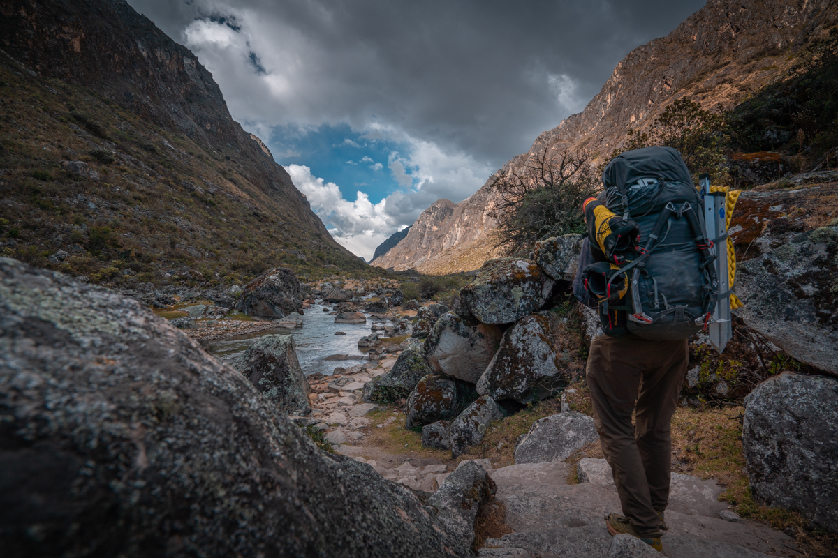
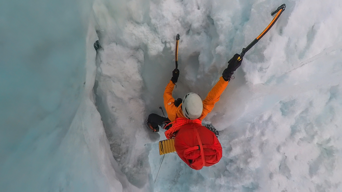
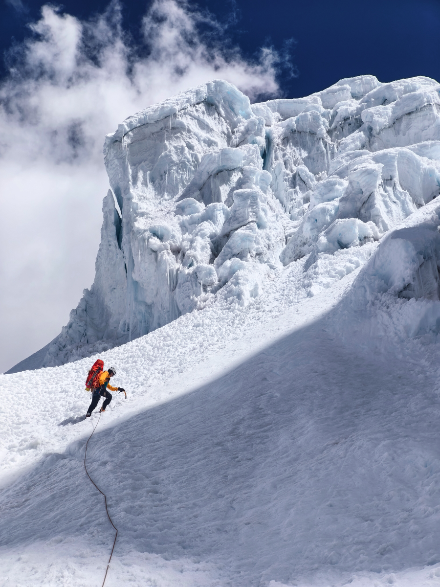
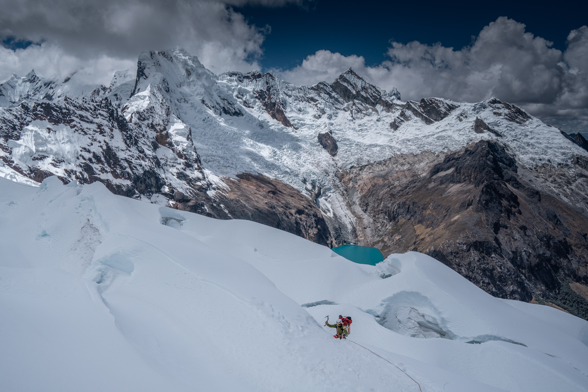
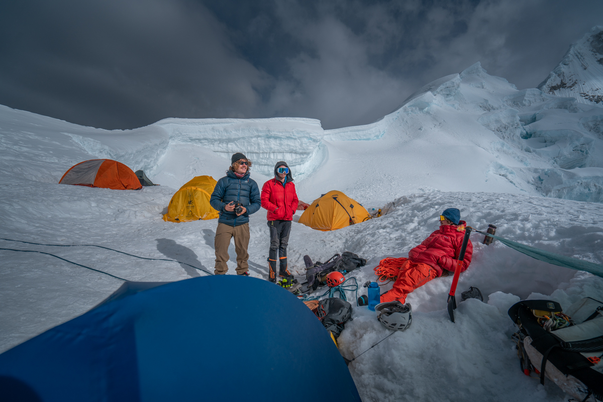
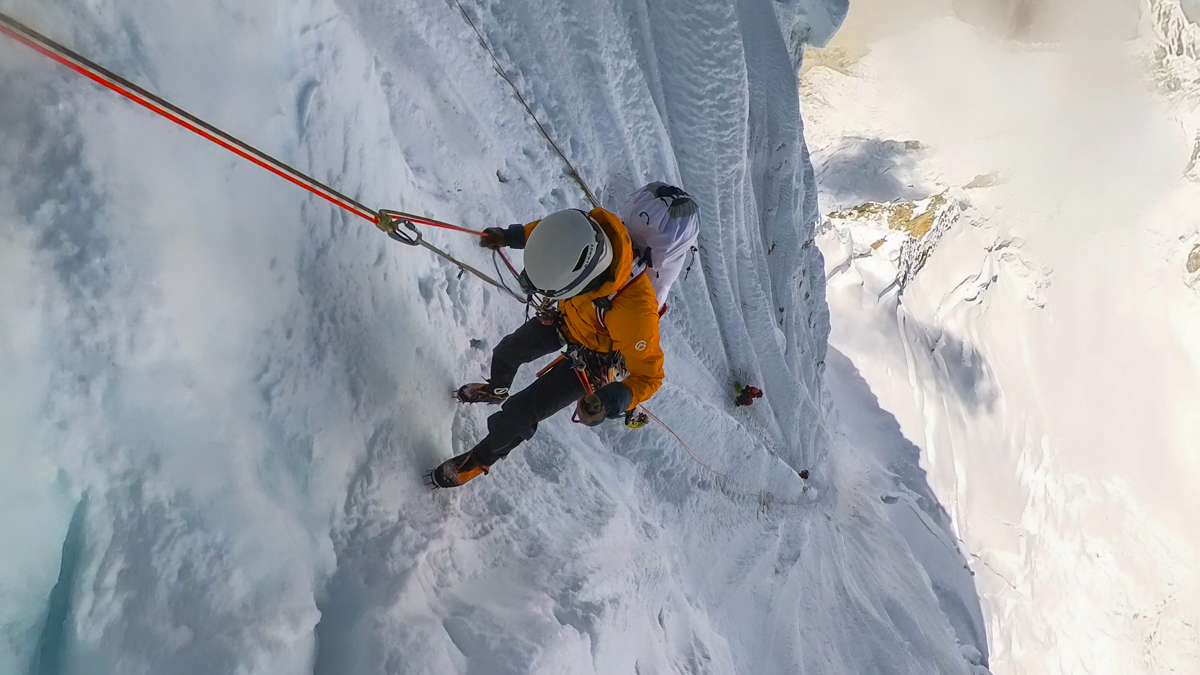
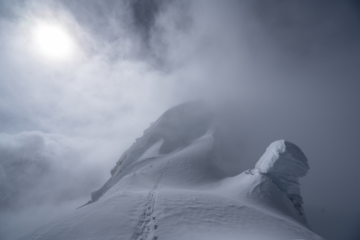
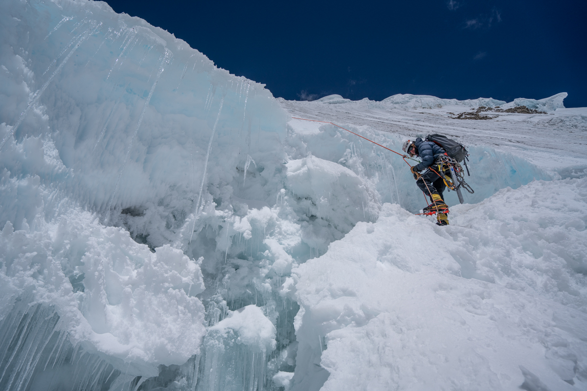
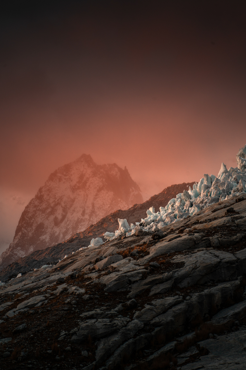
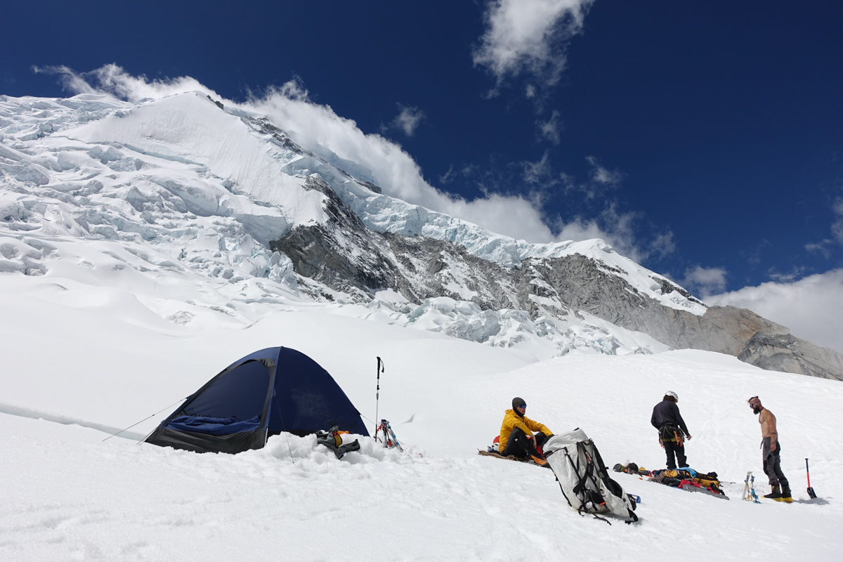
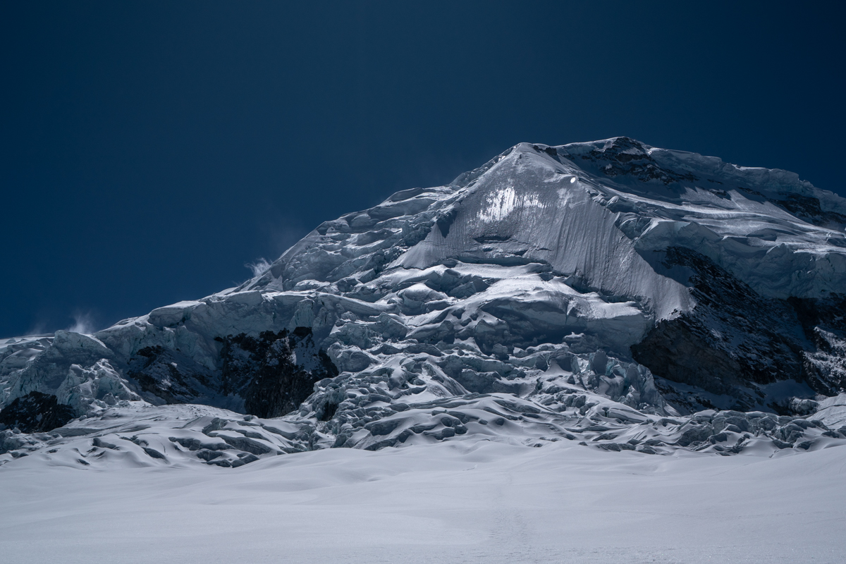
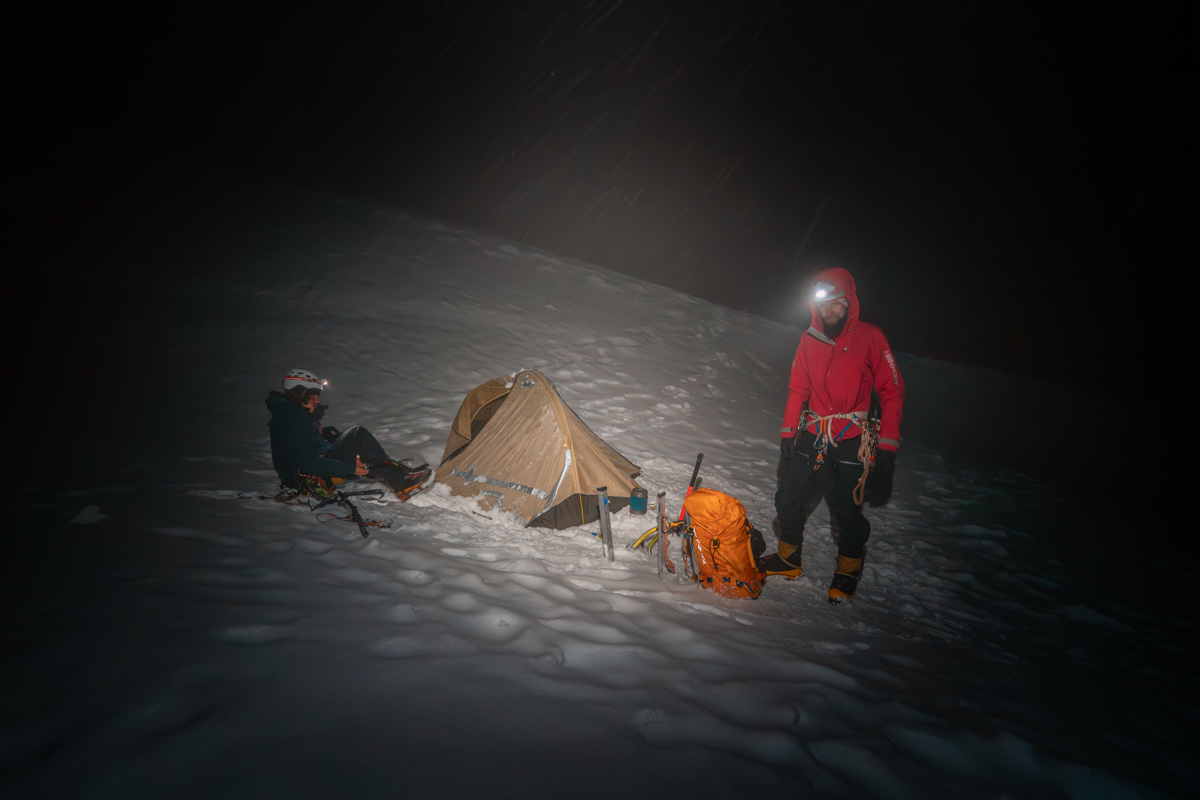
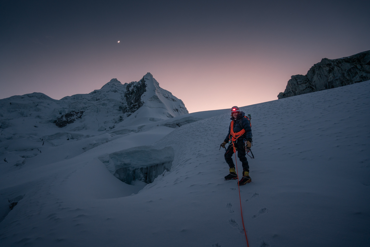
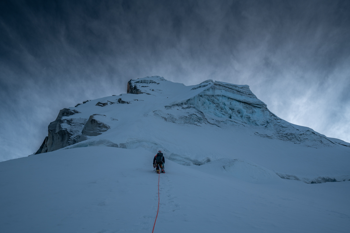
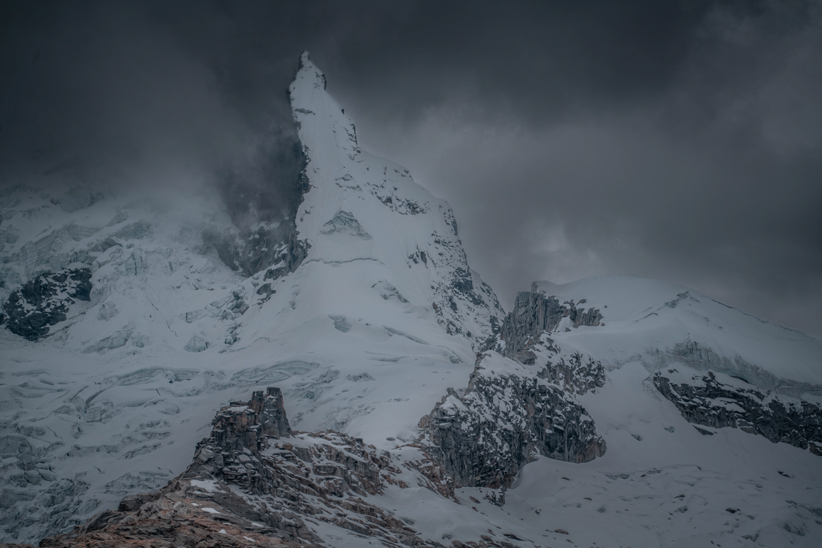
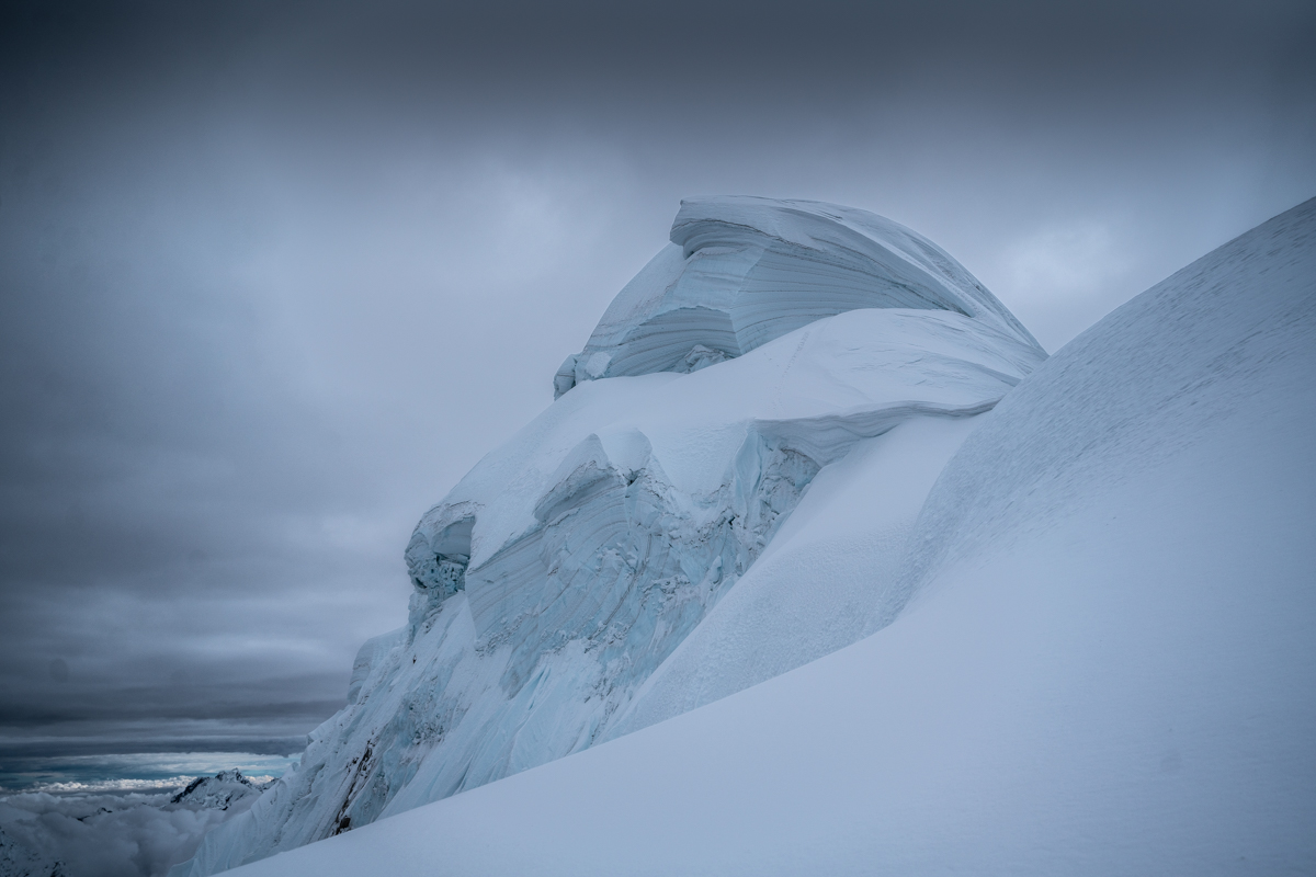
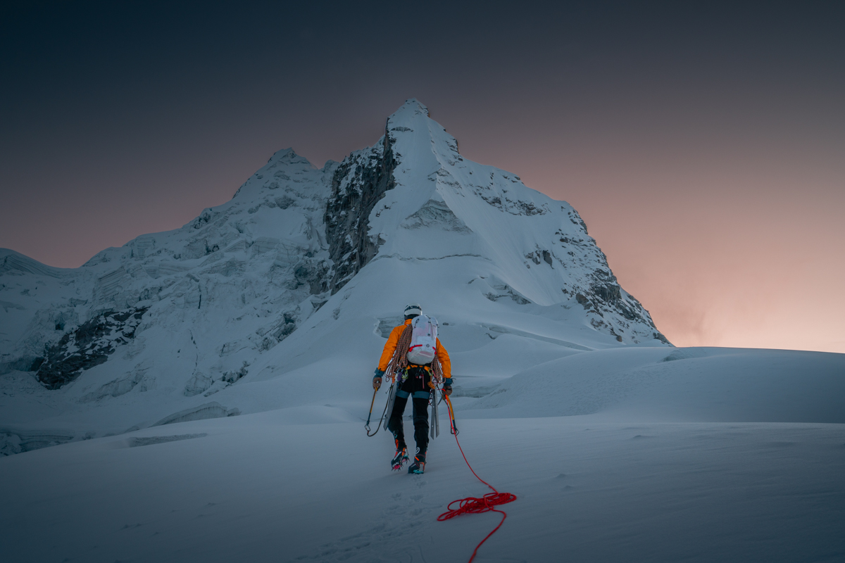
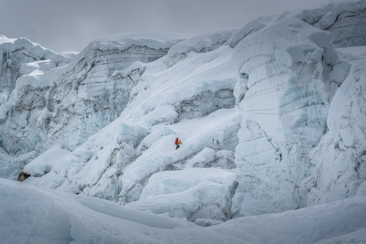
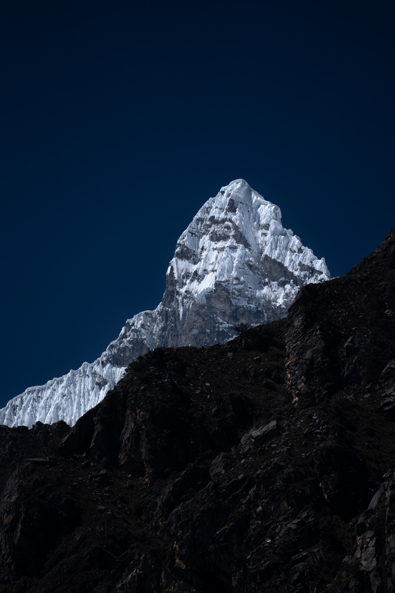
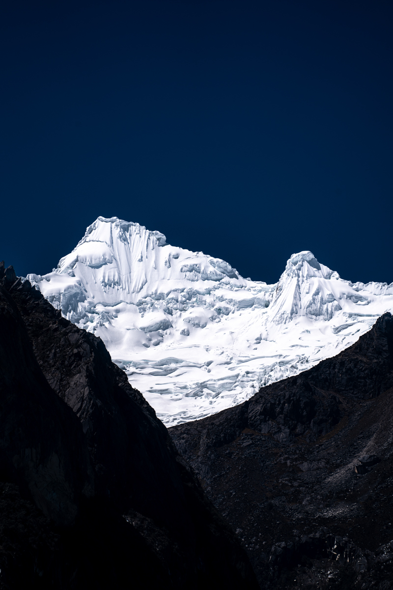
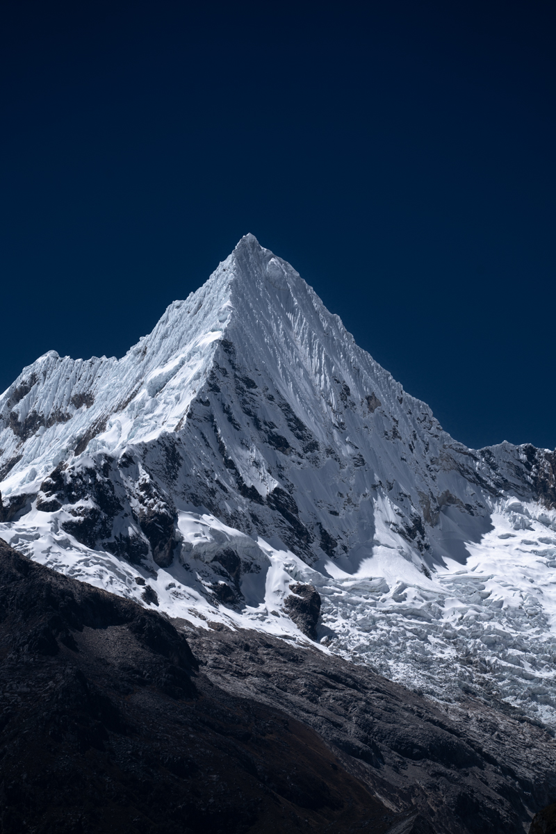
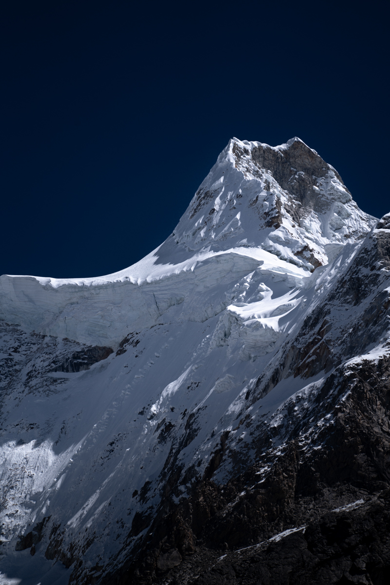
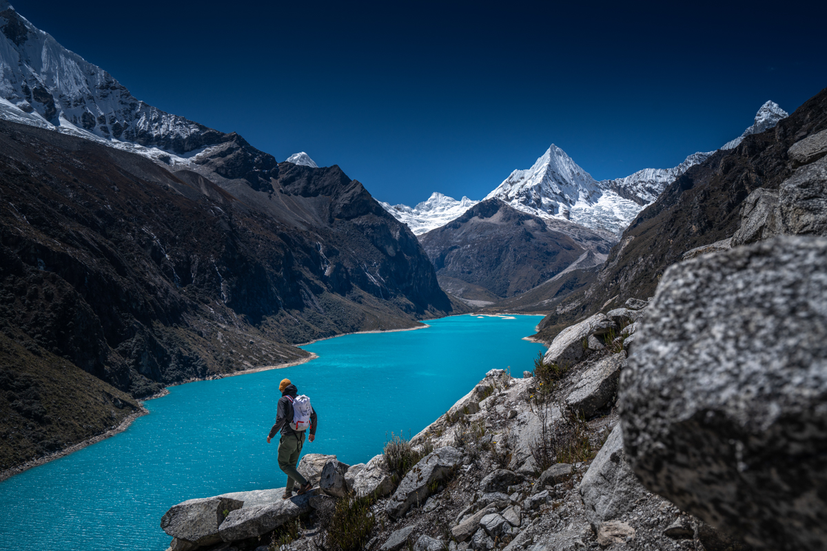
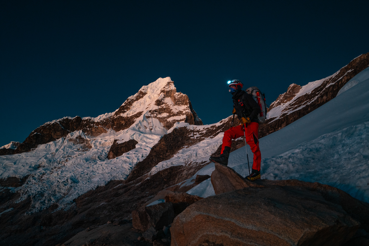
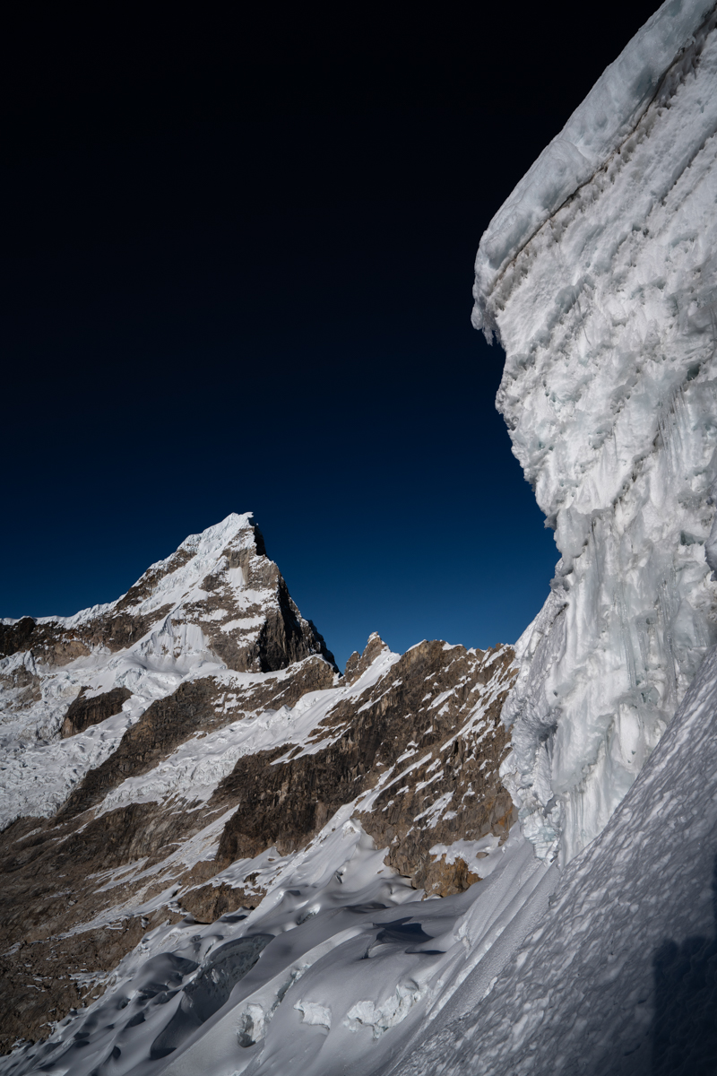
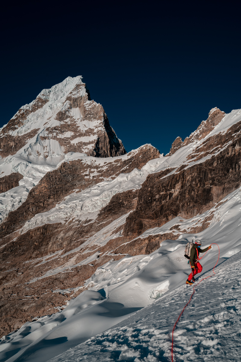
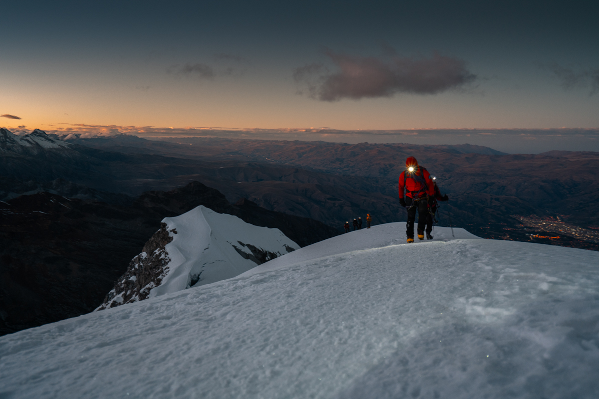
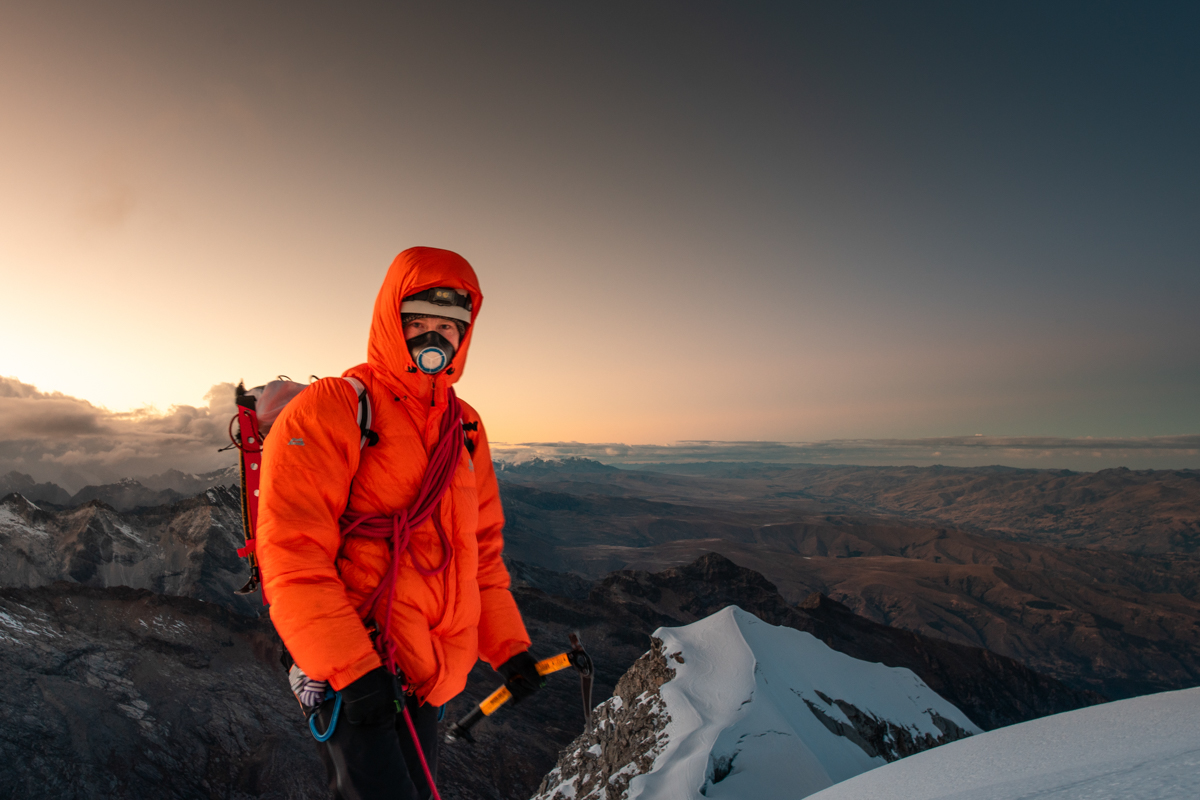
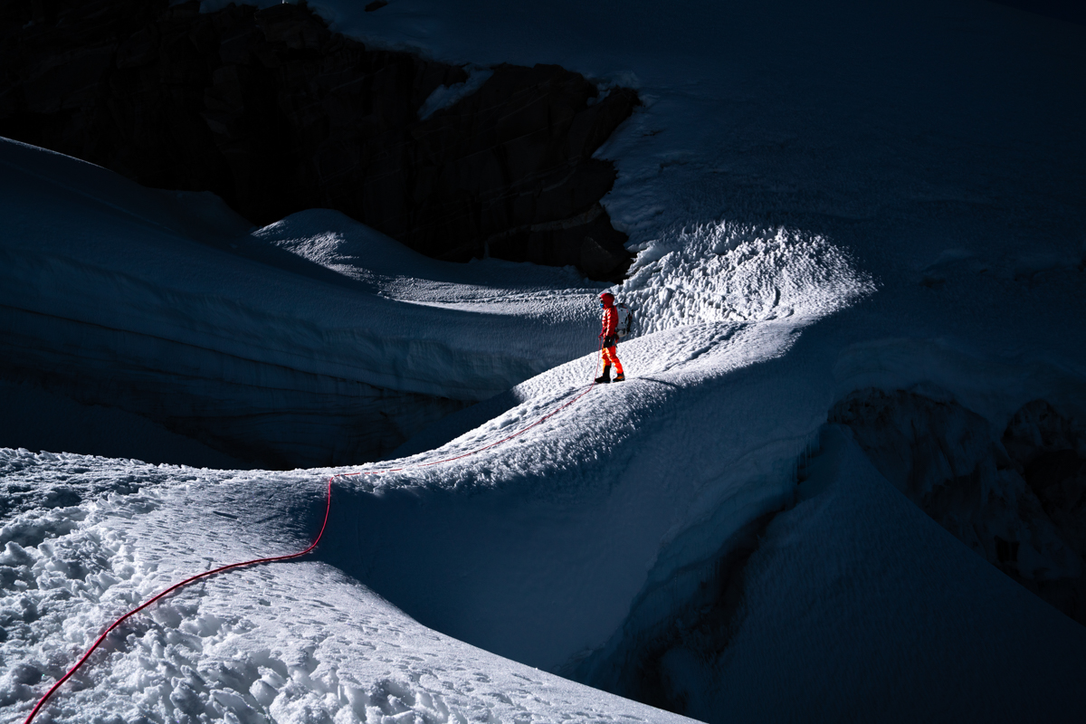
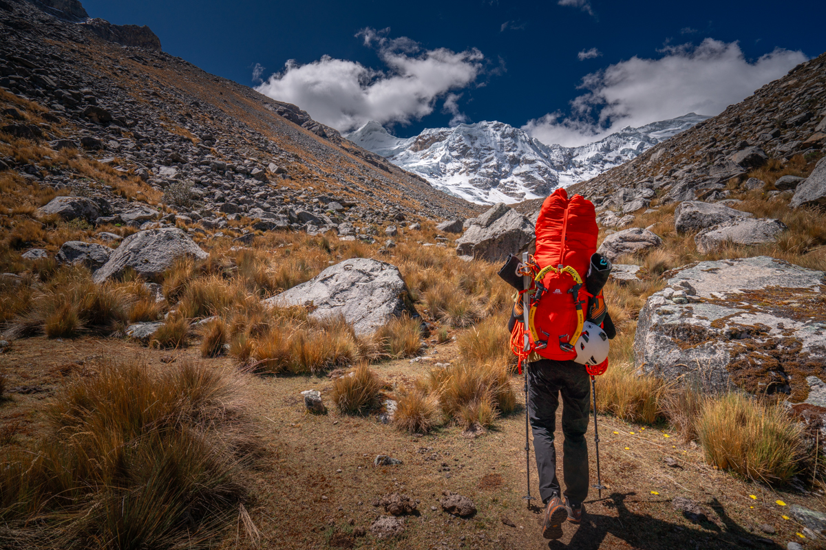
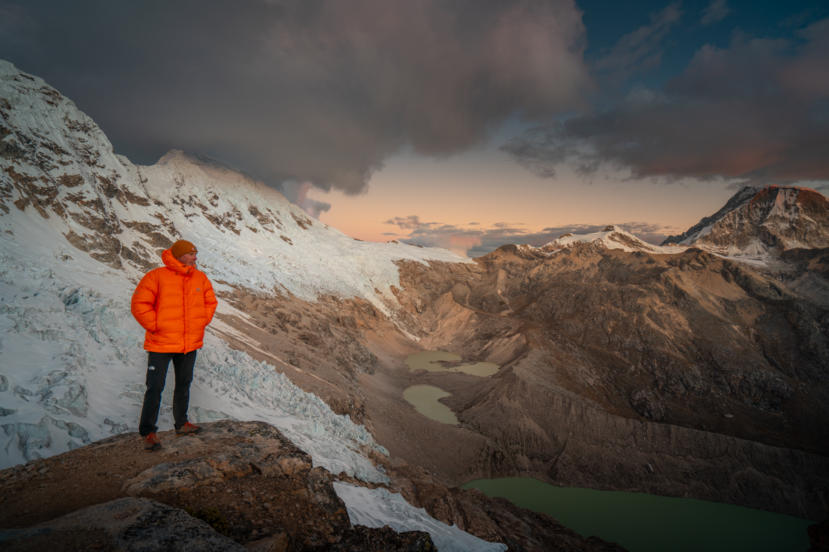
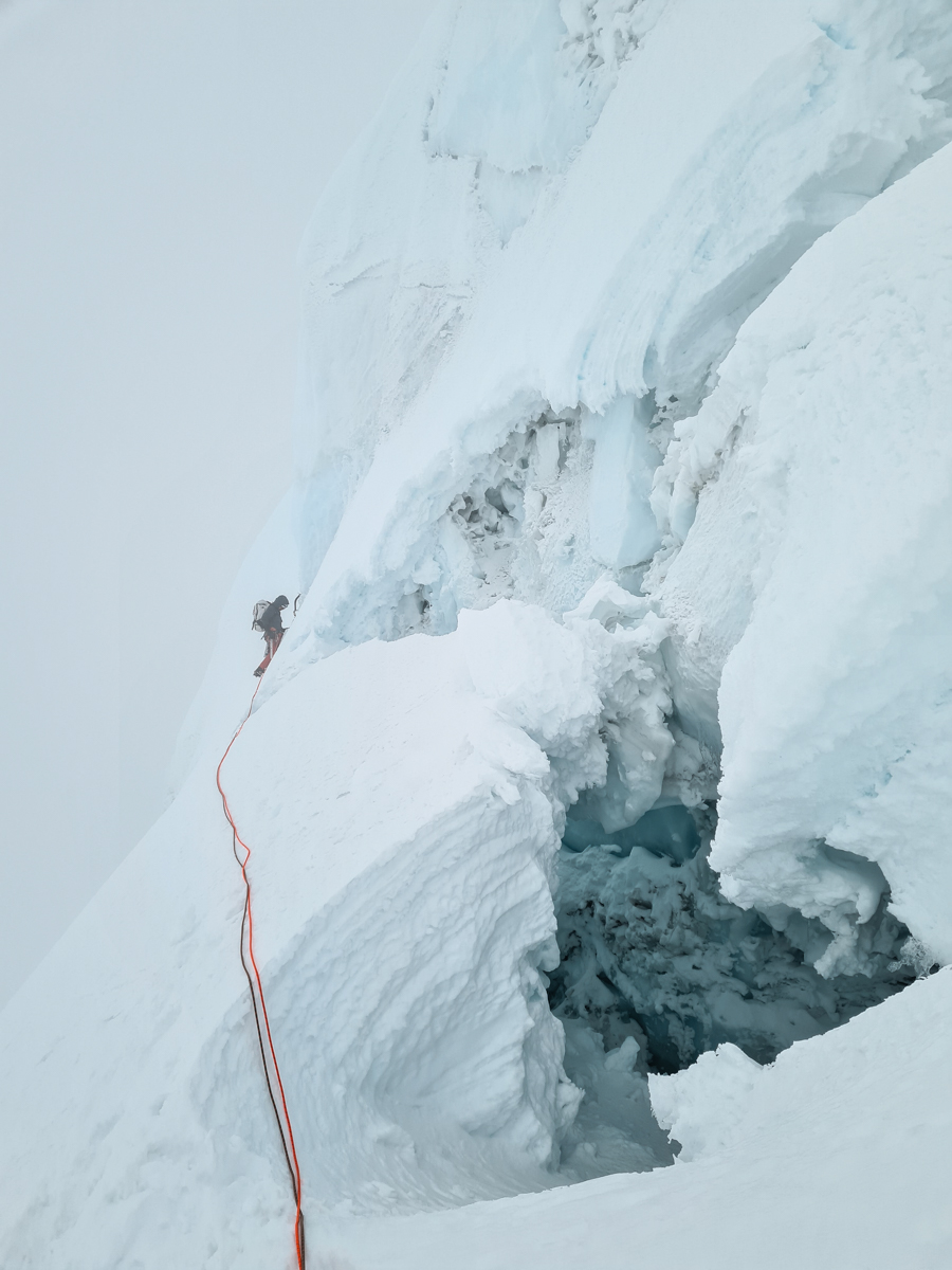
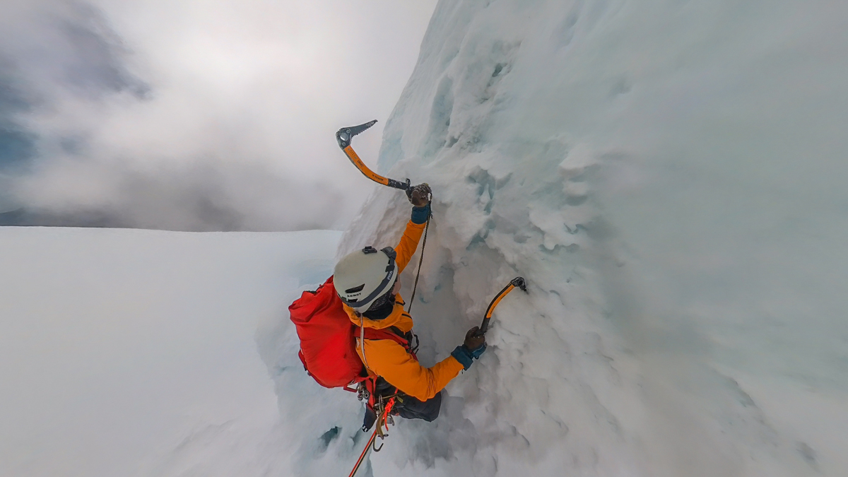
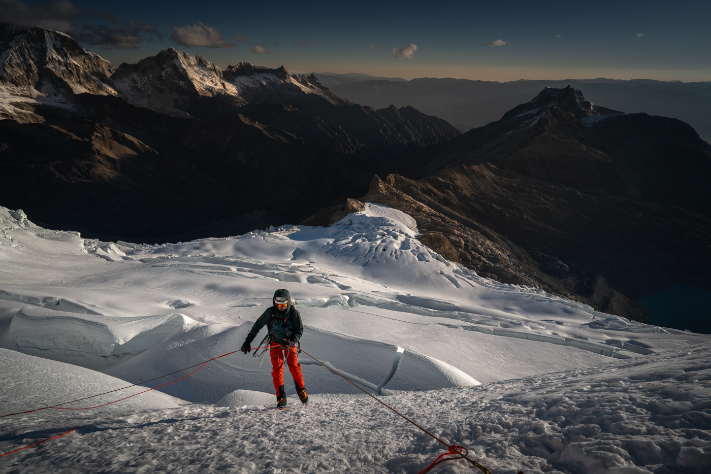
Our goal was to climb Tocllaraju via the West Face. To reach the several-hundred-meter-high ice wall, we followed the tracks of the normal route across the glacier at night before branching off to the right towards the face. It was an extremely windy night and so cold that I even put on my thick down pants. At the bergschrund, we first struggled to find a way across. After several unsuccessful attempts, Luca found a spot where it was relatively narrow, and we managed to cross.

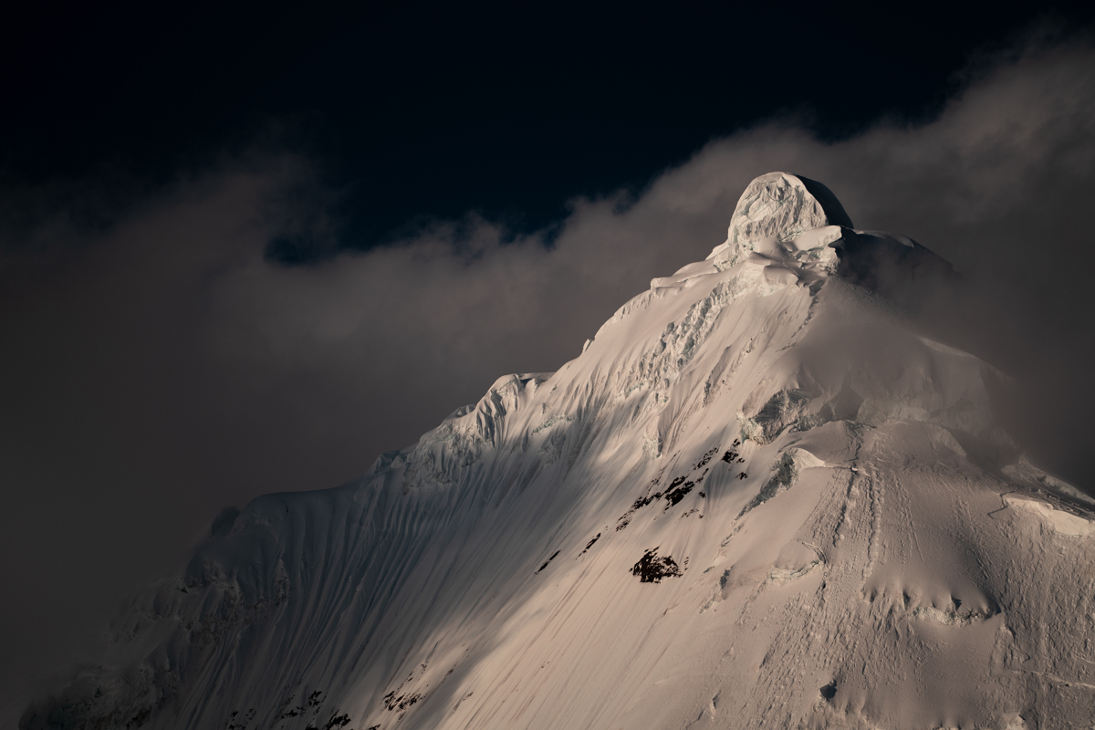
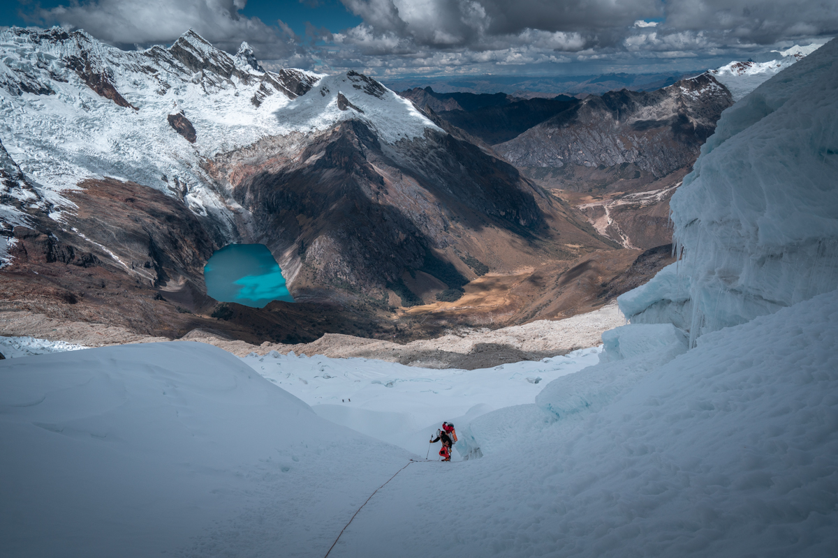
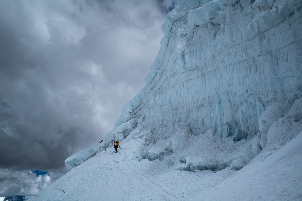
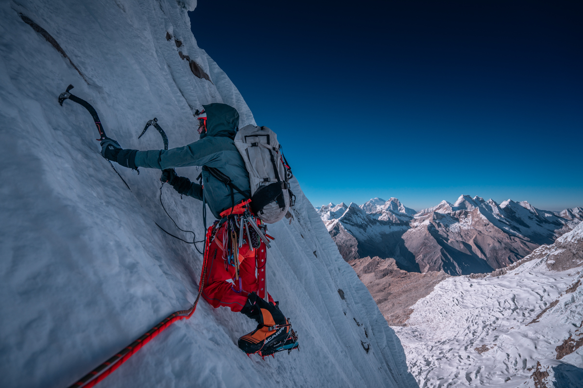
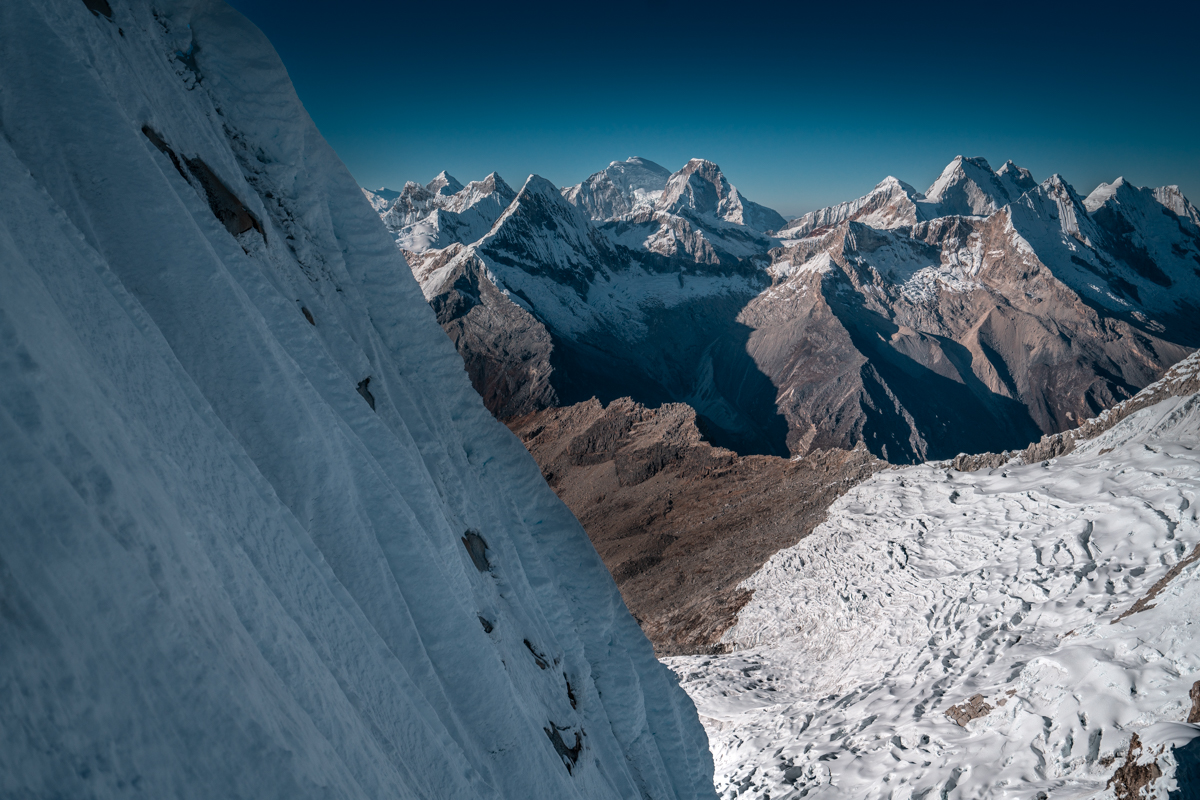
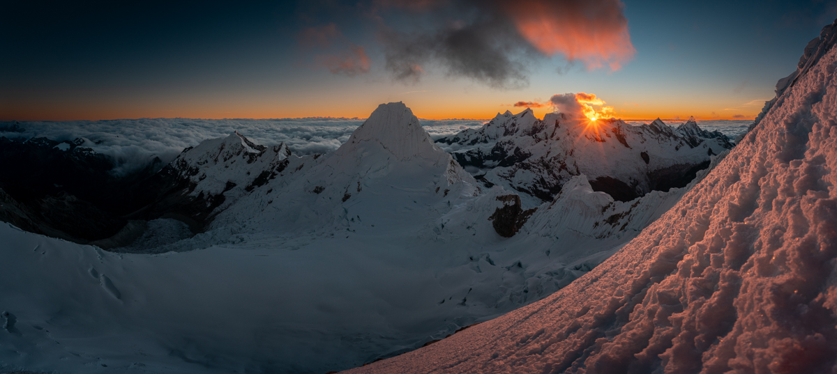
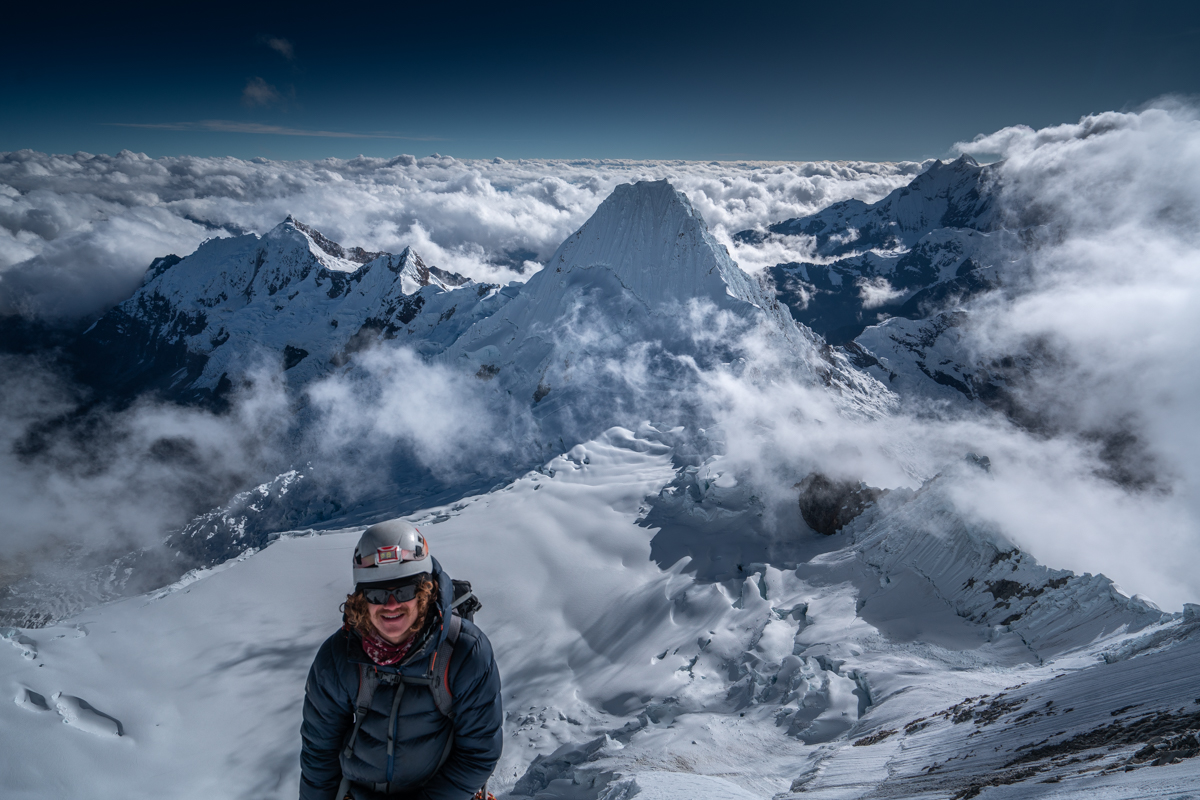
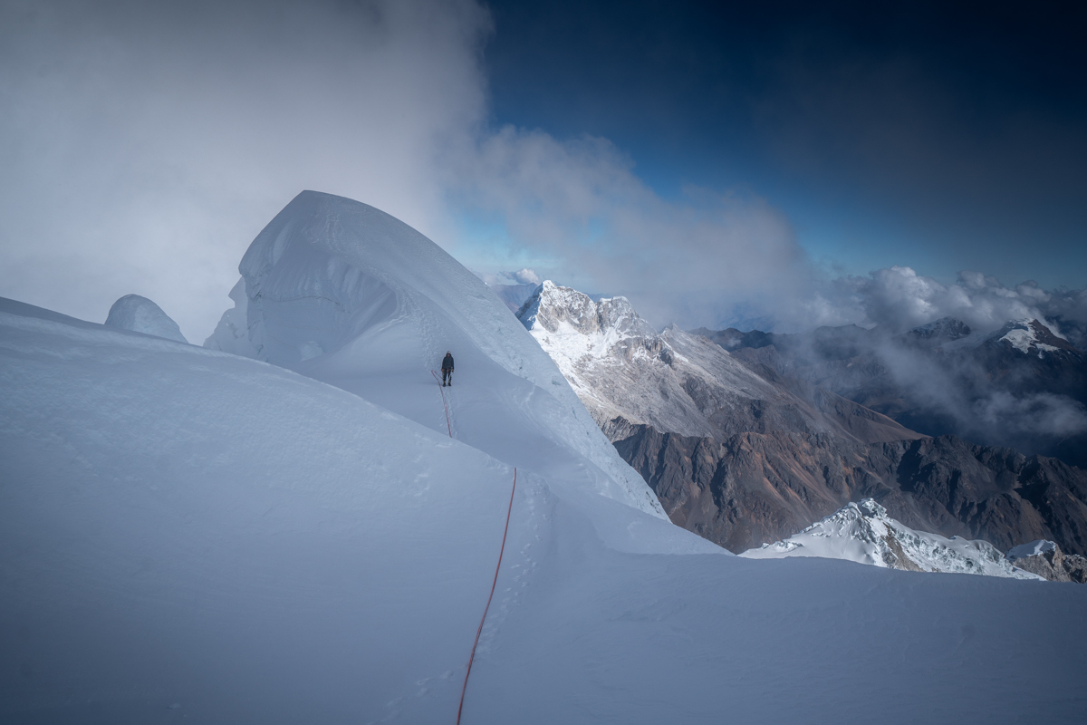
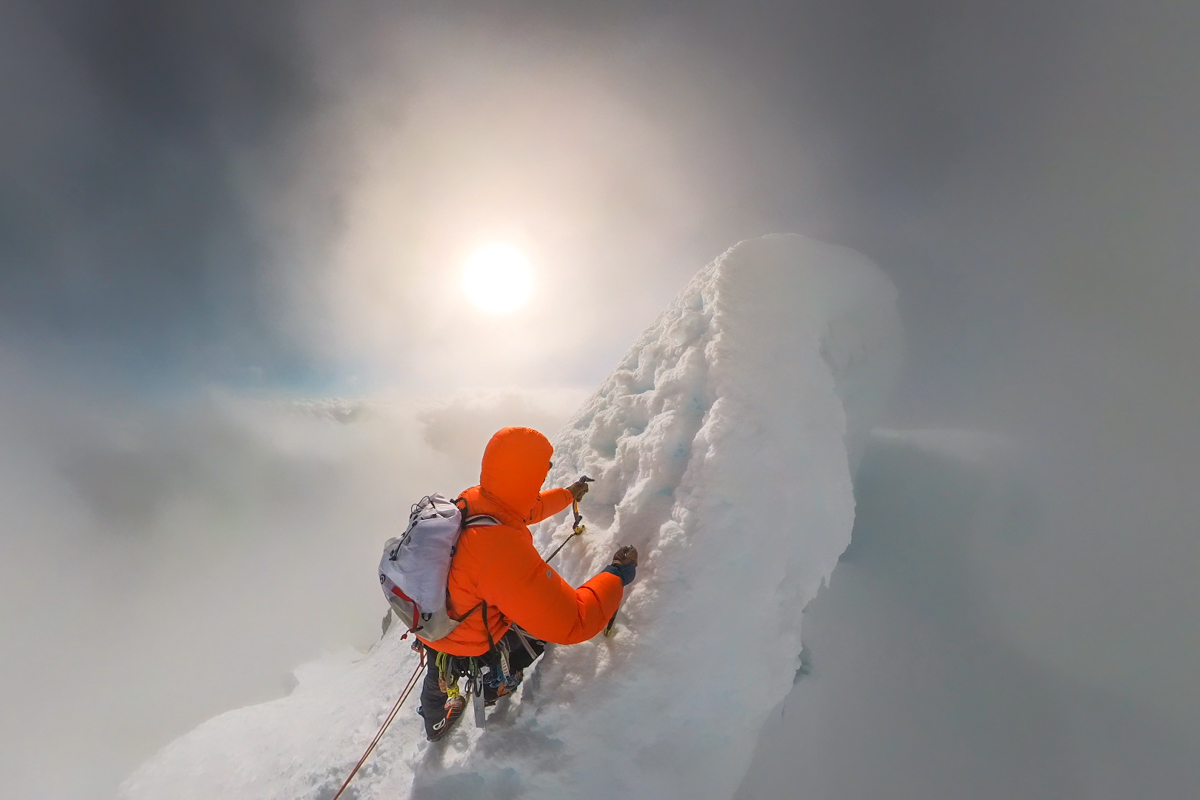
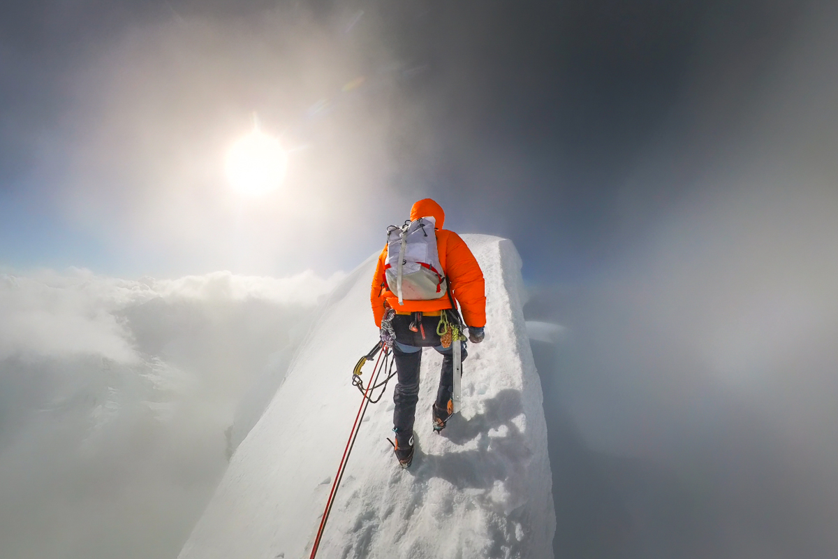
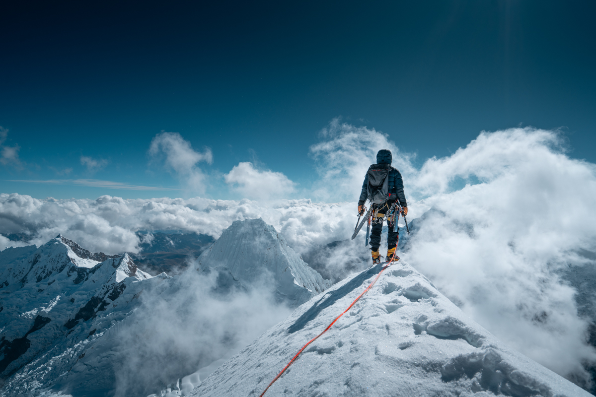
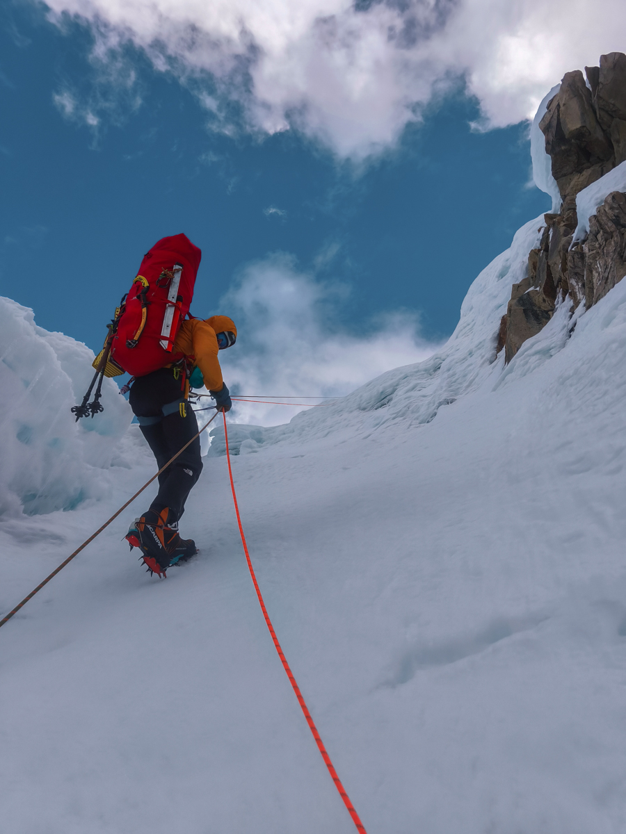
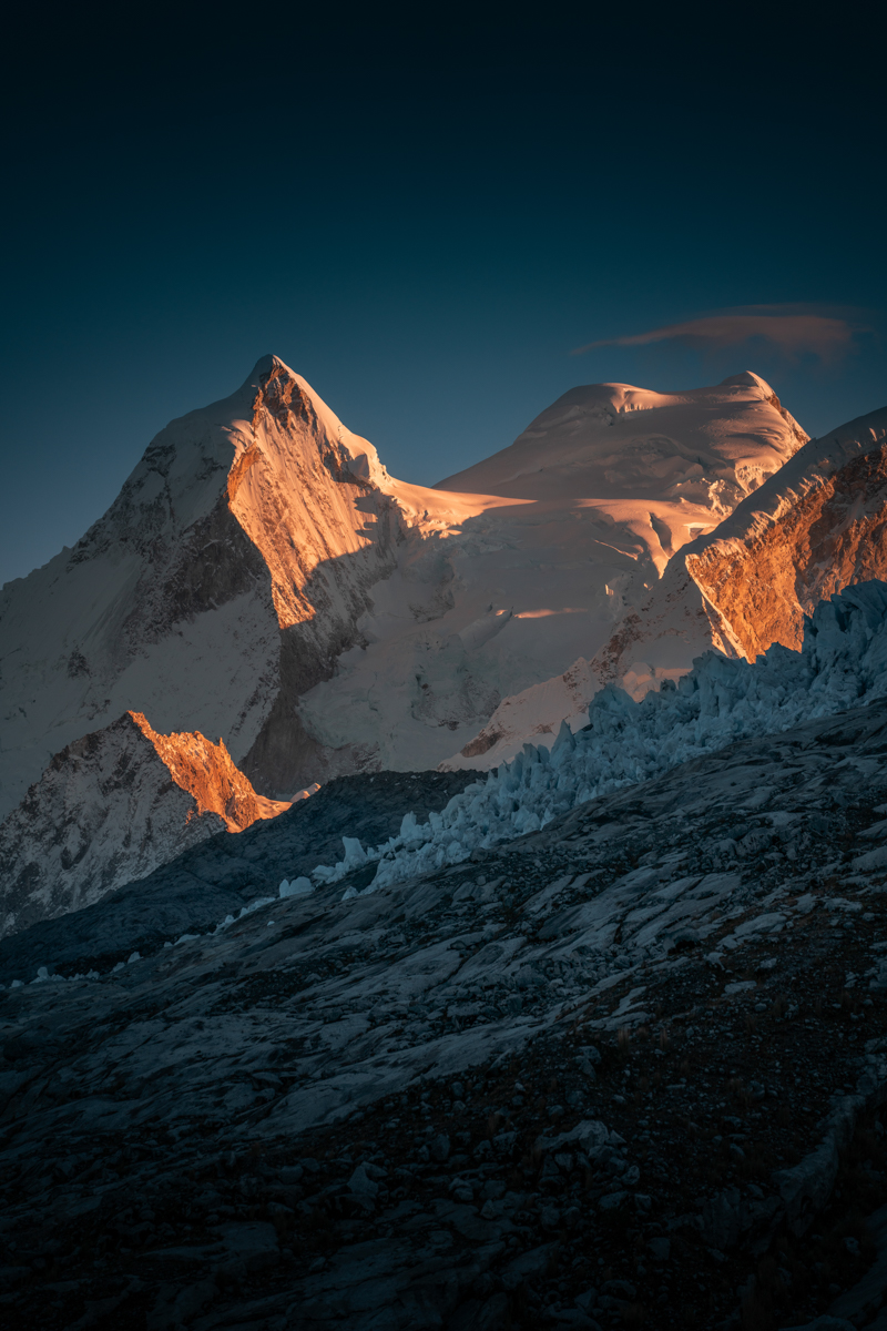
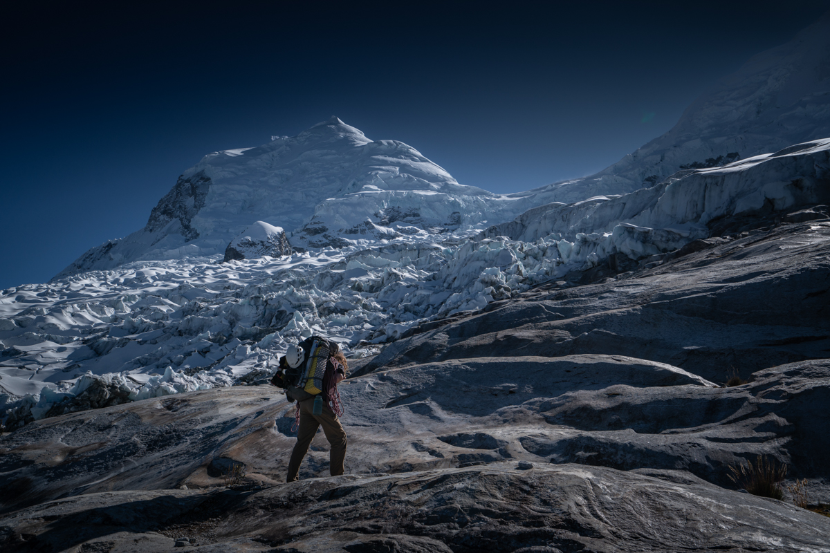
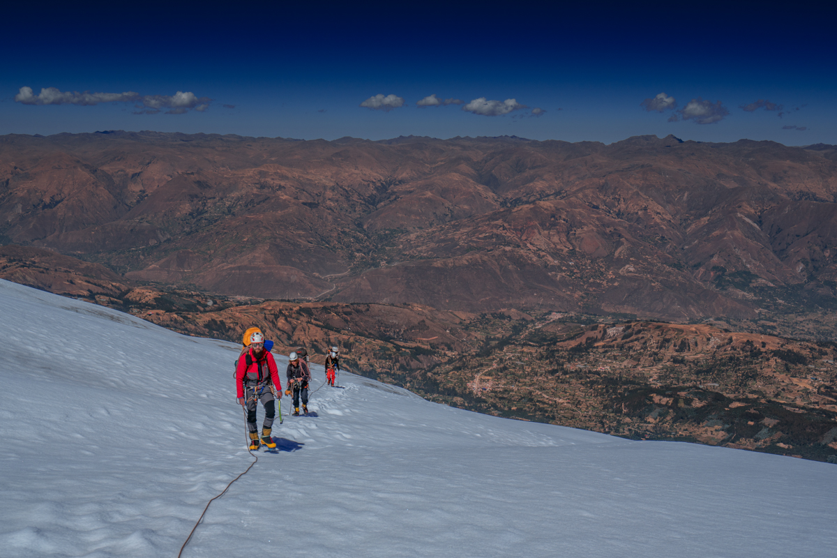
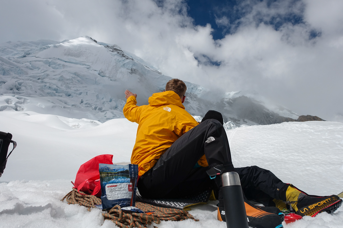
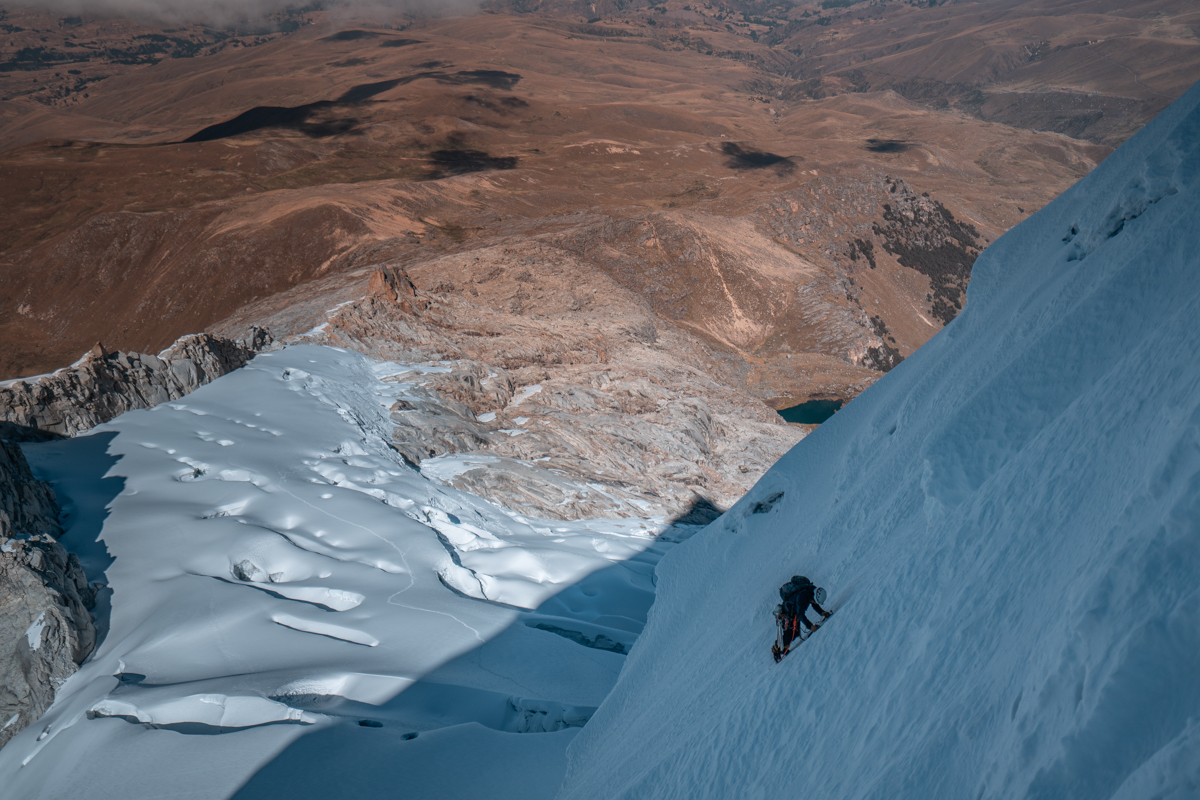
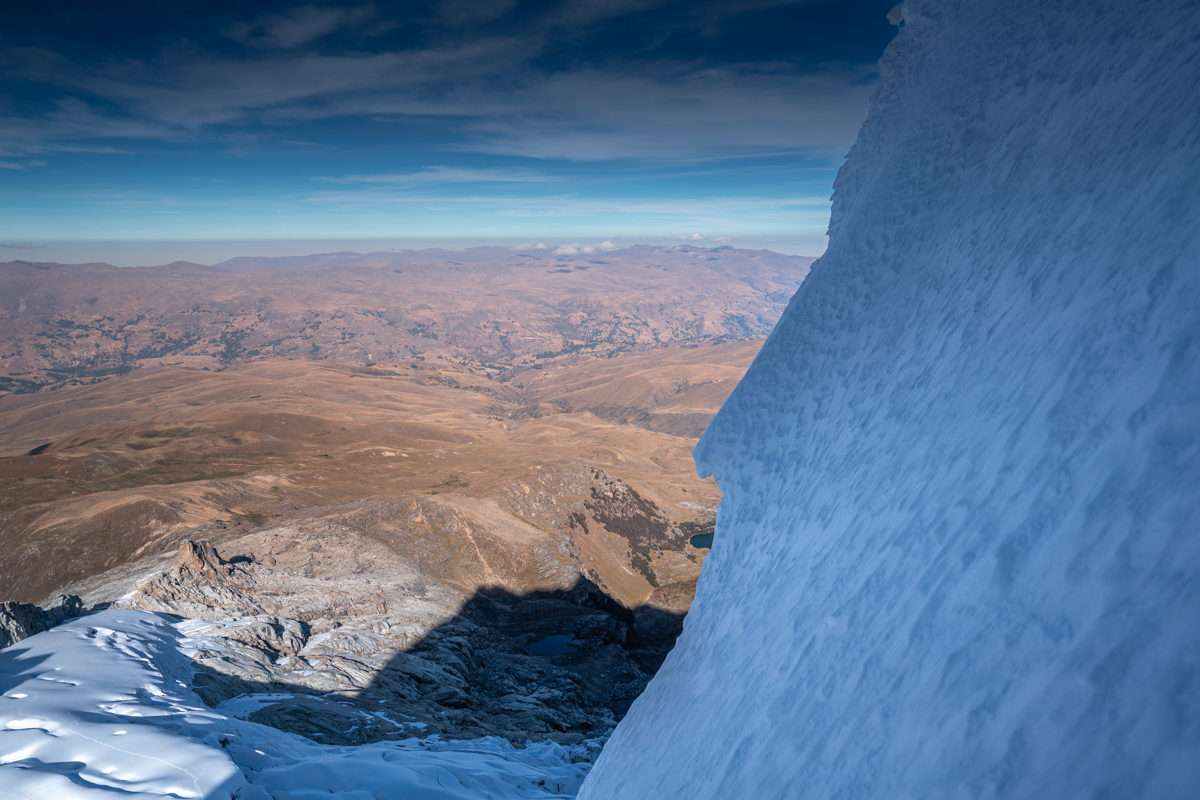
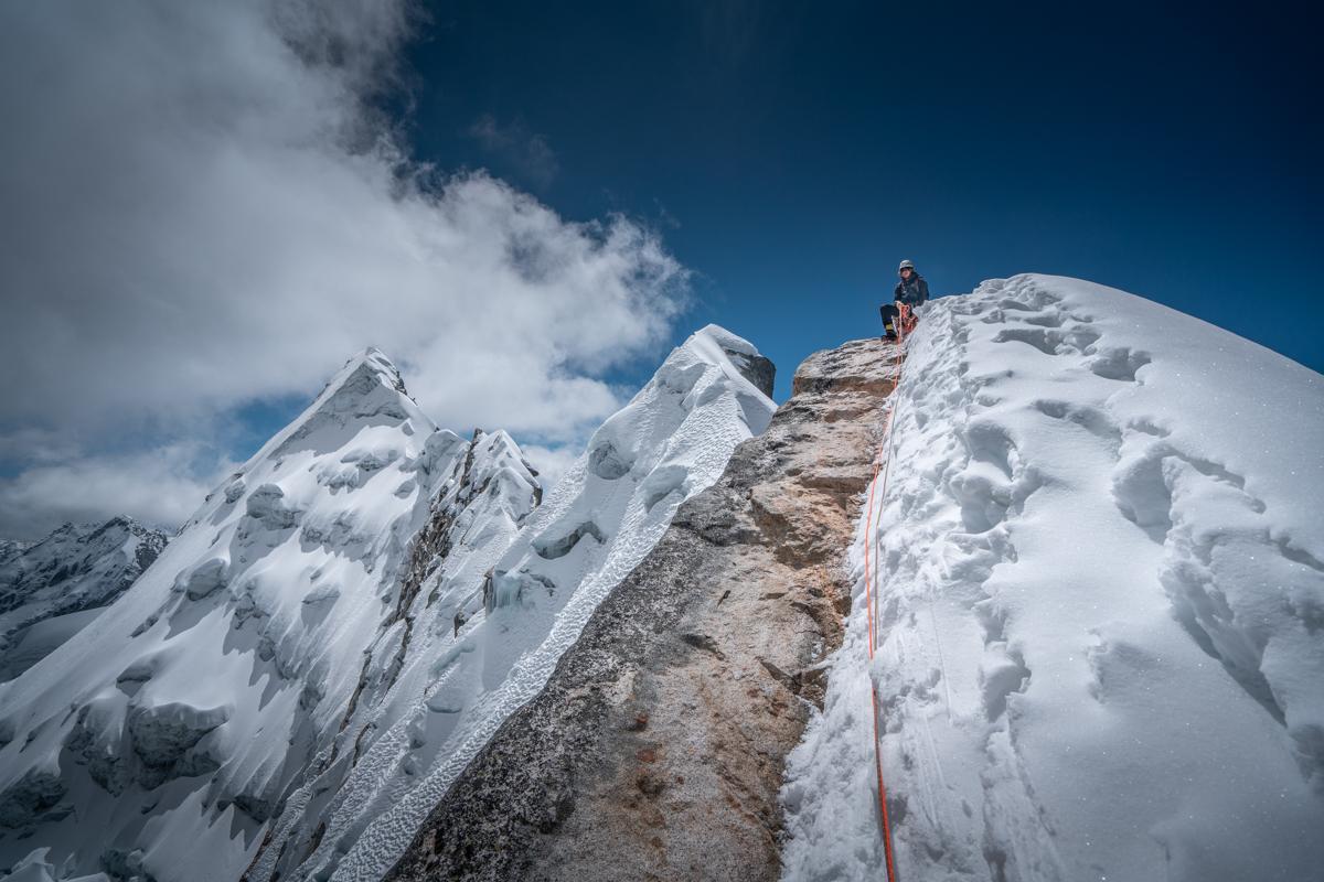
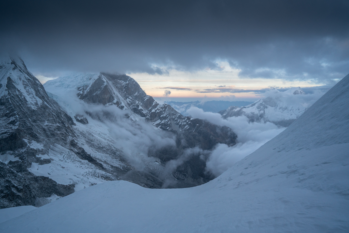
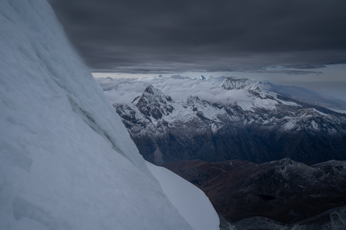
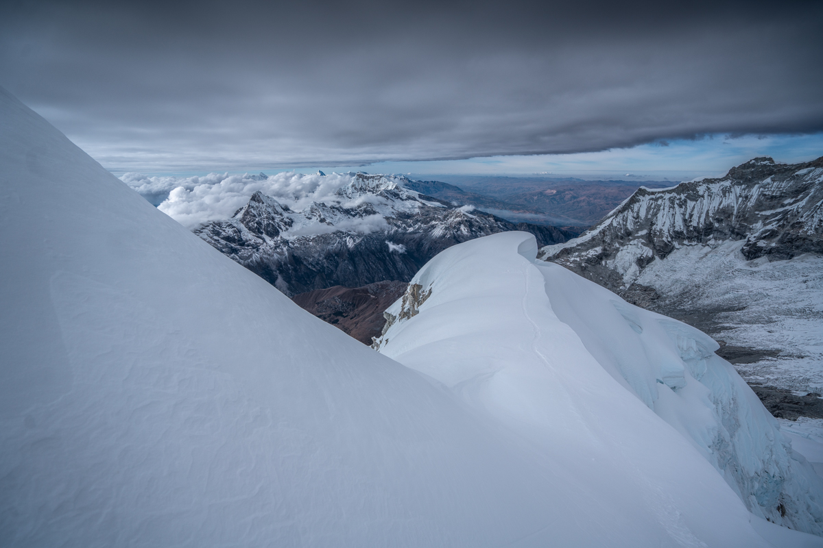
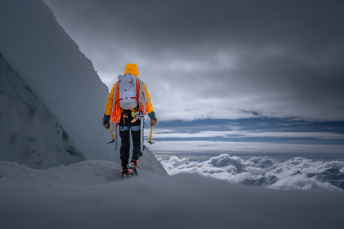
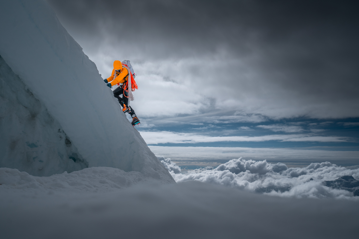
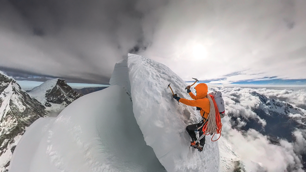
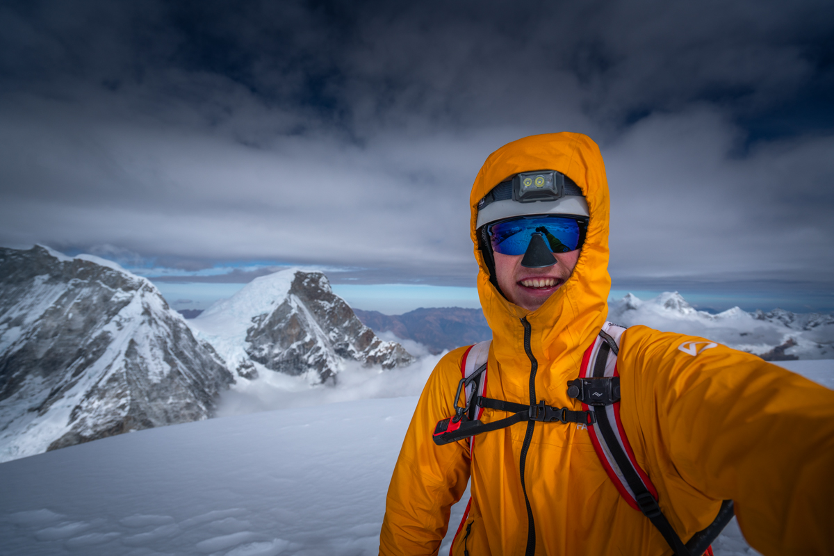
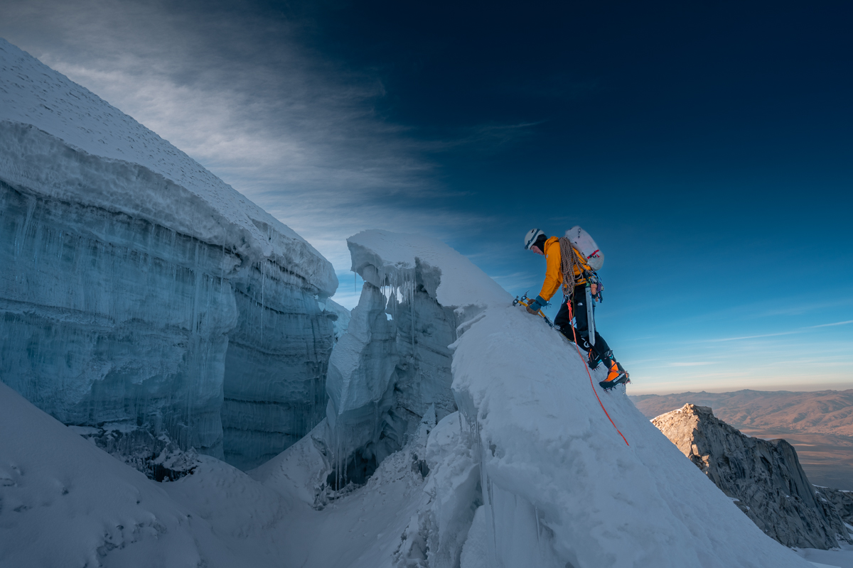
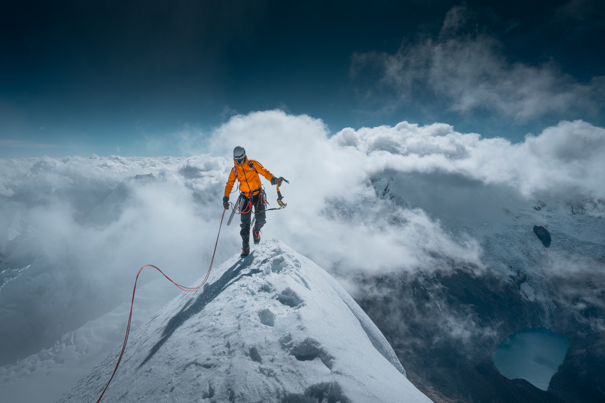
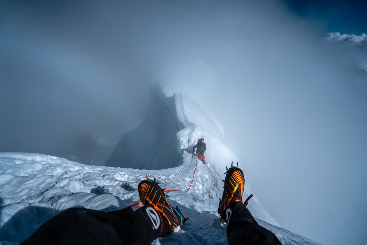
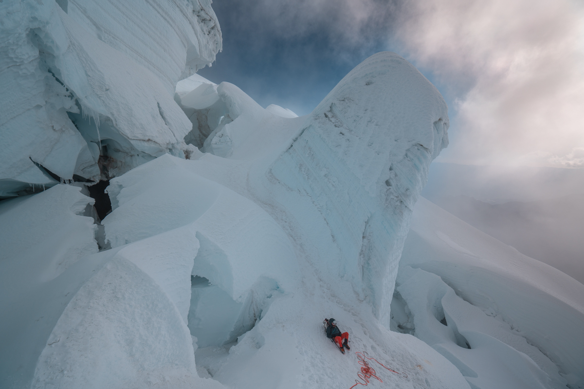
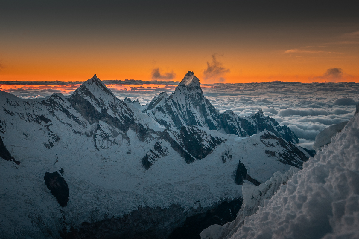
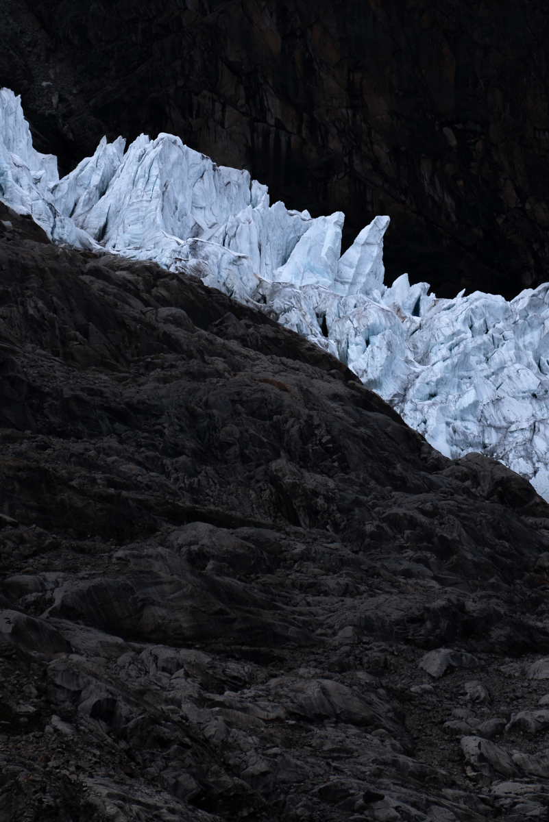
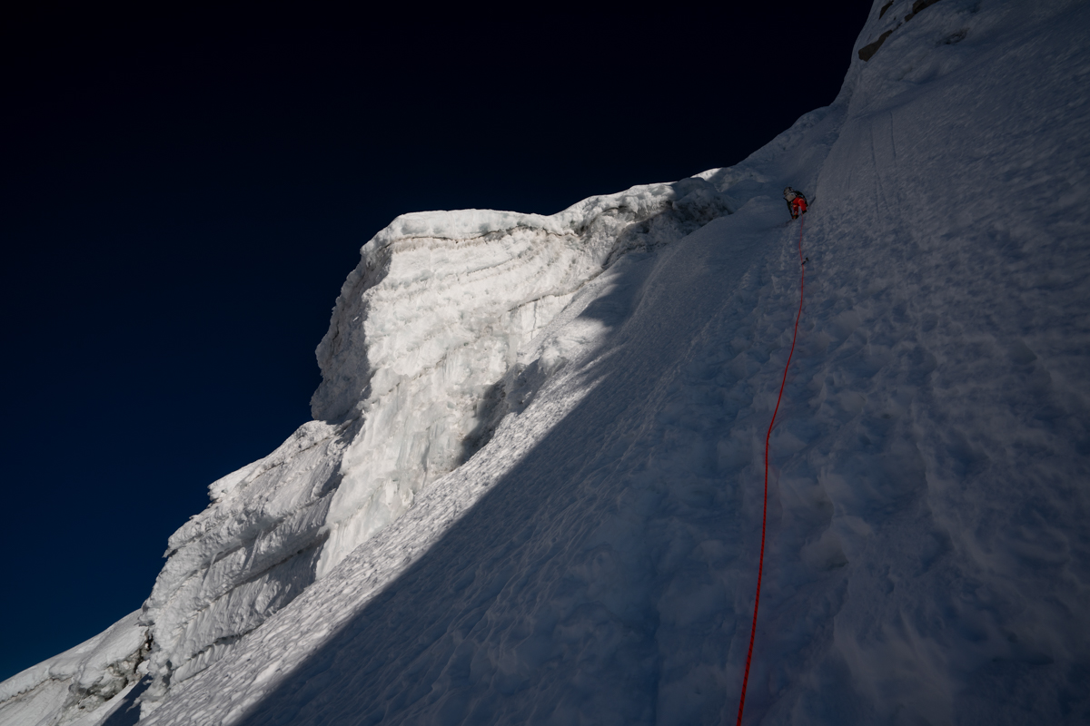
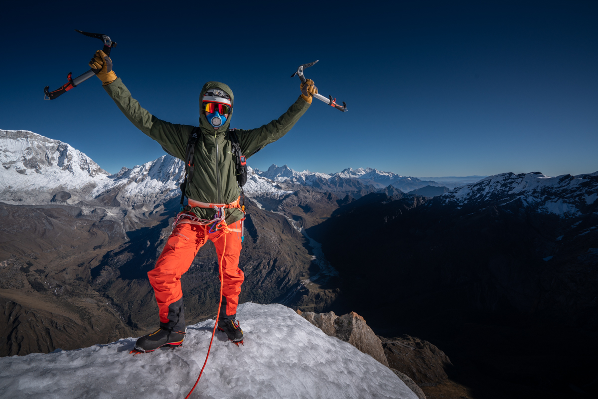
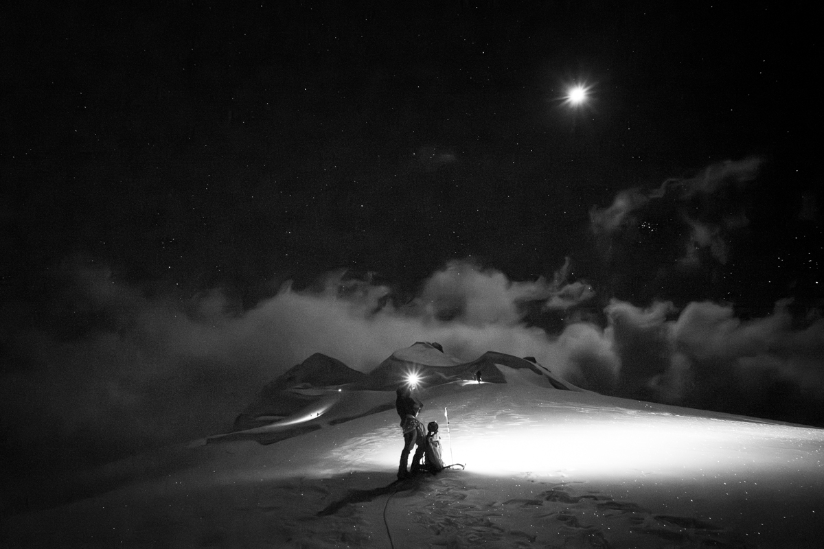
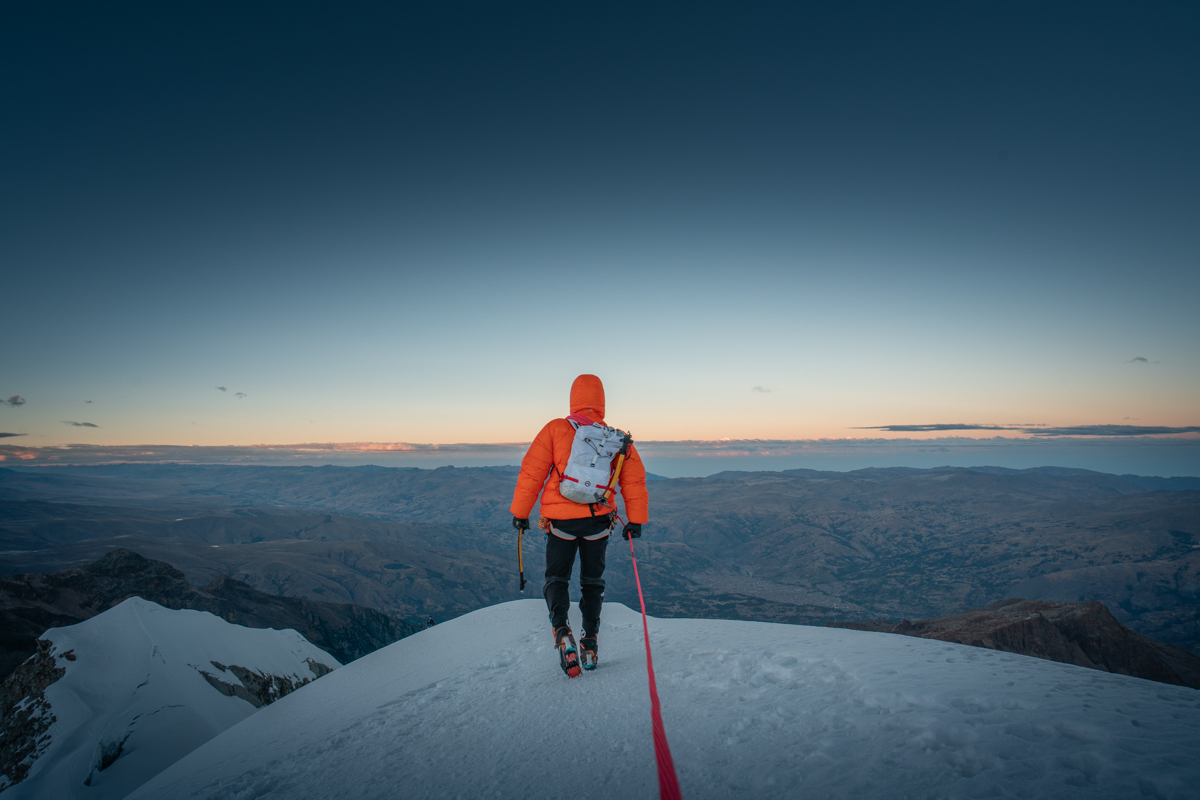
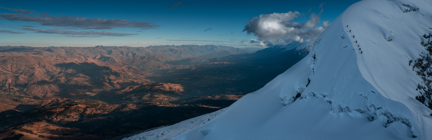
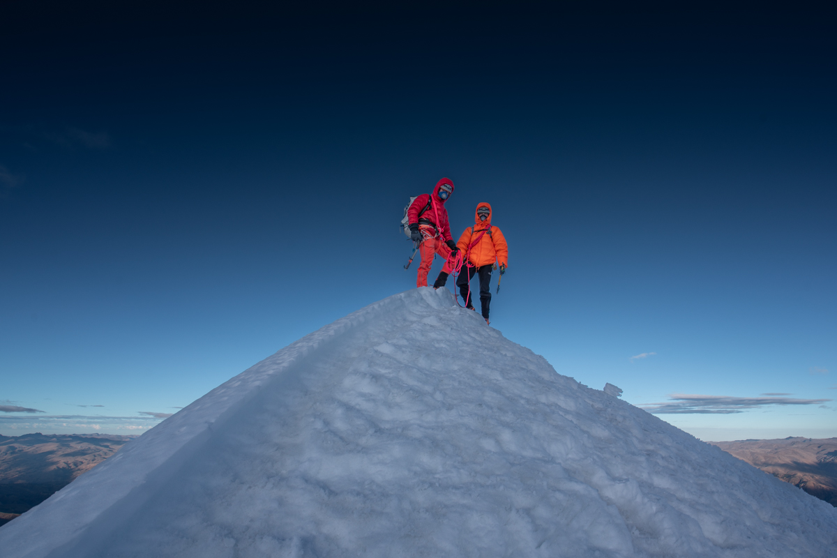
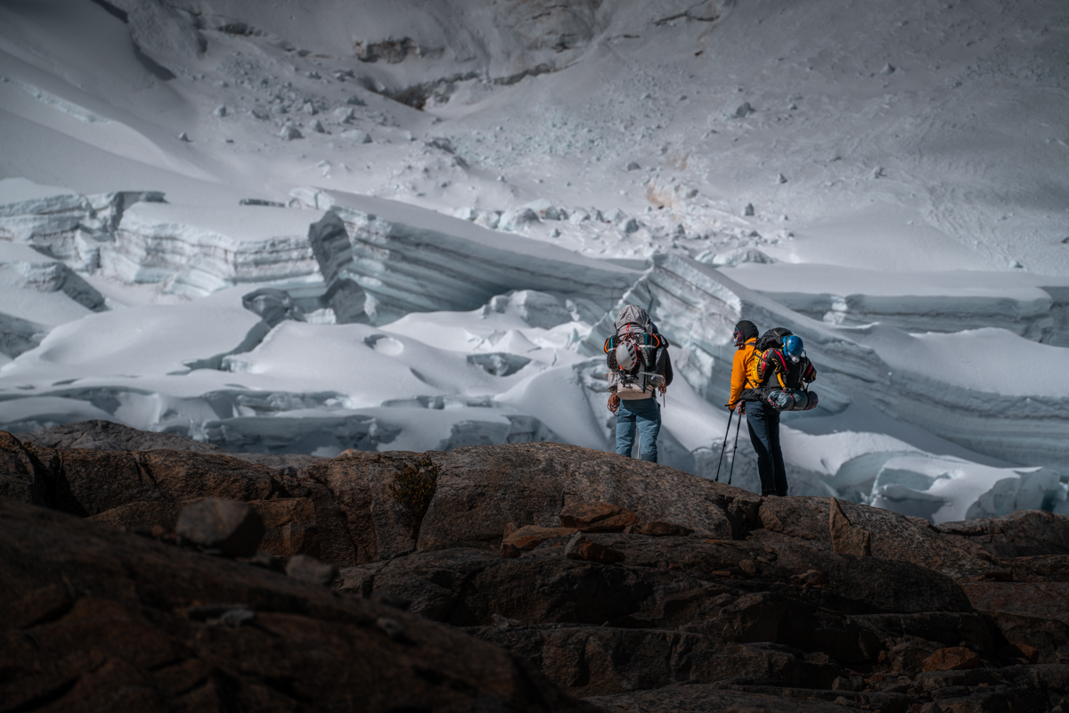
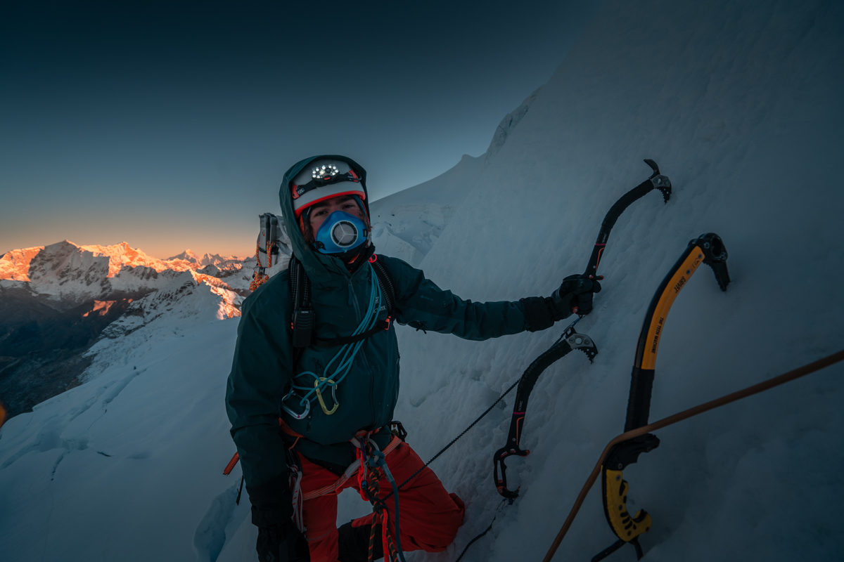
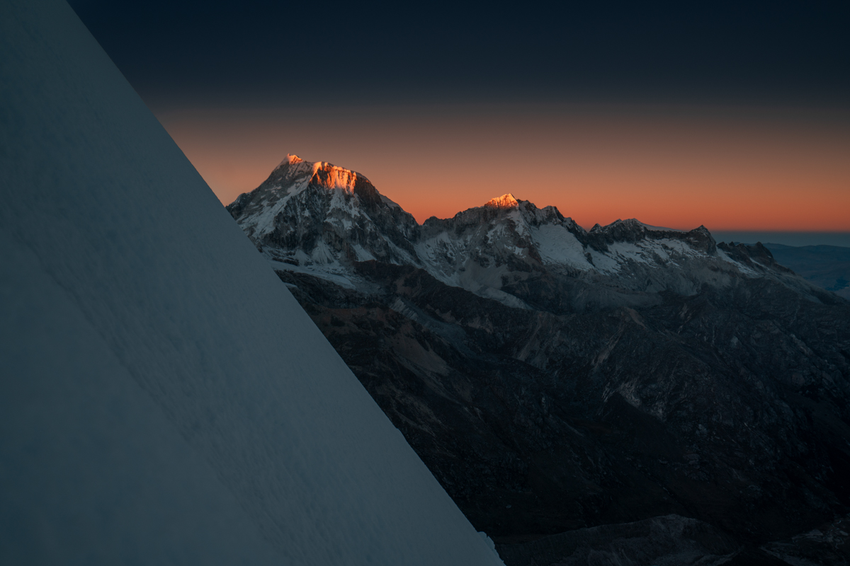
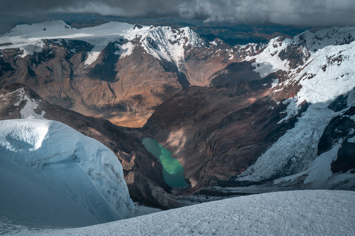
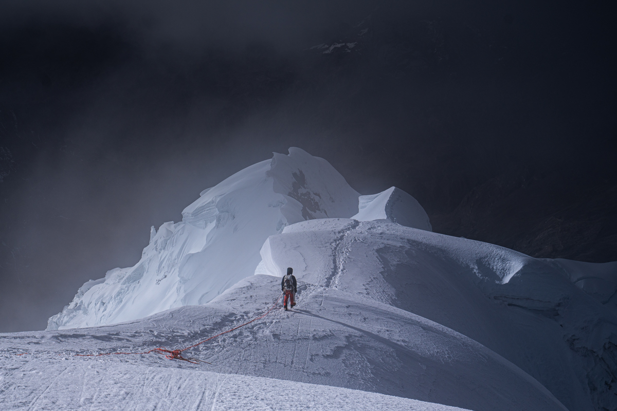
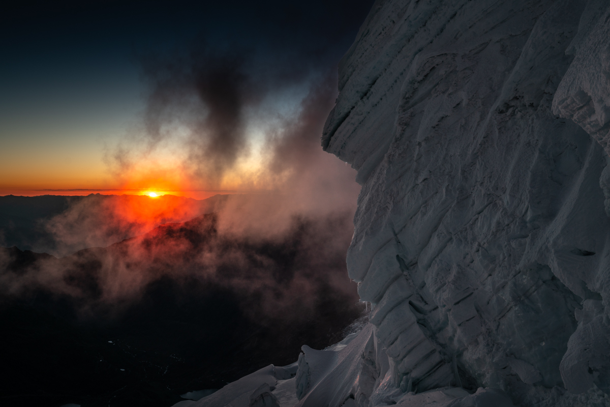
What followed were many pitches of up to 70-degree ice and snow. Conditions were good but climbing at nearly 6,000 meters was increasingly exhausting. After a few hours, we traversed out of the face and continued the ascent along a shoulder. It was less steep than the West Face but completely loaded with snow, which made progress extremely slow and strenuous. At times, I was wading through snow up to my hips. Eventually, we realized that the route as we had planned it — and as local mountain guides had described it — was impossible because it was cut off by a massive crevasse. So we began searching for an alternative. In doing so, we climbed up seracs and had to cross more large crevasses until we reached the normal route on the other side of the summit serac and followed it for the final five minutes to the top.

After 15 hours and 30 minutes, we had made it: we stood on the summit of Tocllaraju at 6,034 meters. An indescribable feeling, especially because the weather had turned very foggy during the last hours of the ascent, and just as we reached the summit, it cleared again, rewarding us with incredible views in the afternoon sun.

We descended via the normal route, which was much faster and safer. On the lower section oft he glacier I felt exhausted from the effort of the long day and happy that we had succeeded and left all the difficult sections behind us. To this time another stunning sunset bathed the entire glacier in golden light. A special atmosphere.  After 19 hours on the mountain, we finally reached Tocllaraju High Camp in the dark, and for the first time in more than 24 hours, we had a proper meal.

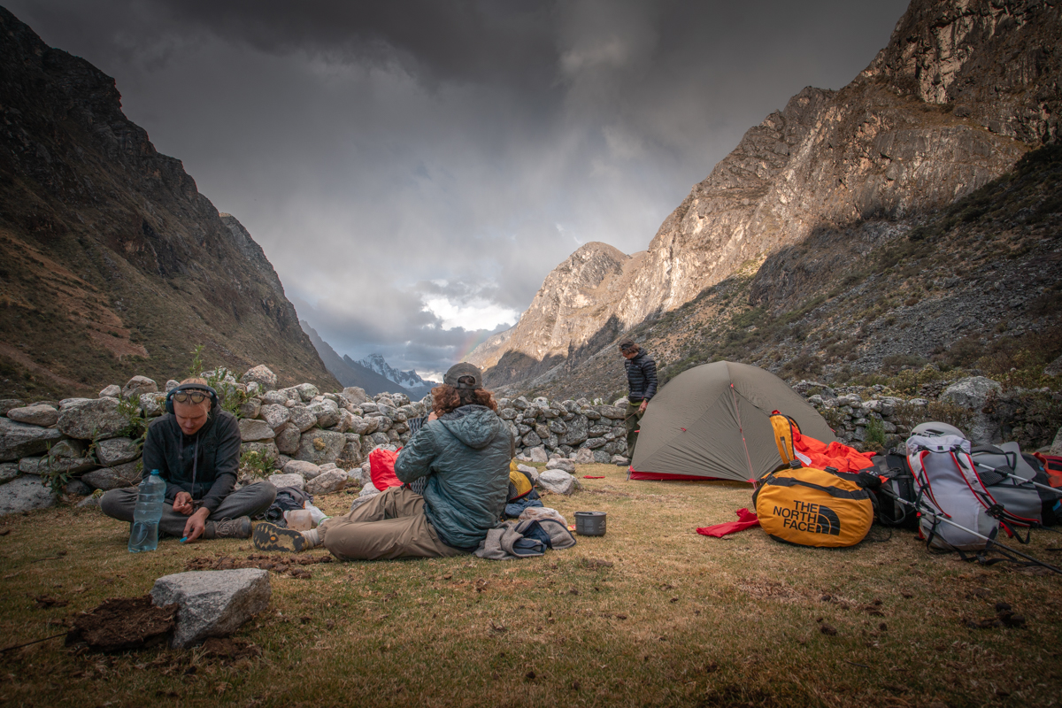
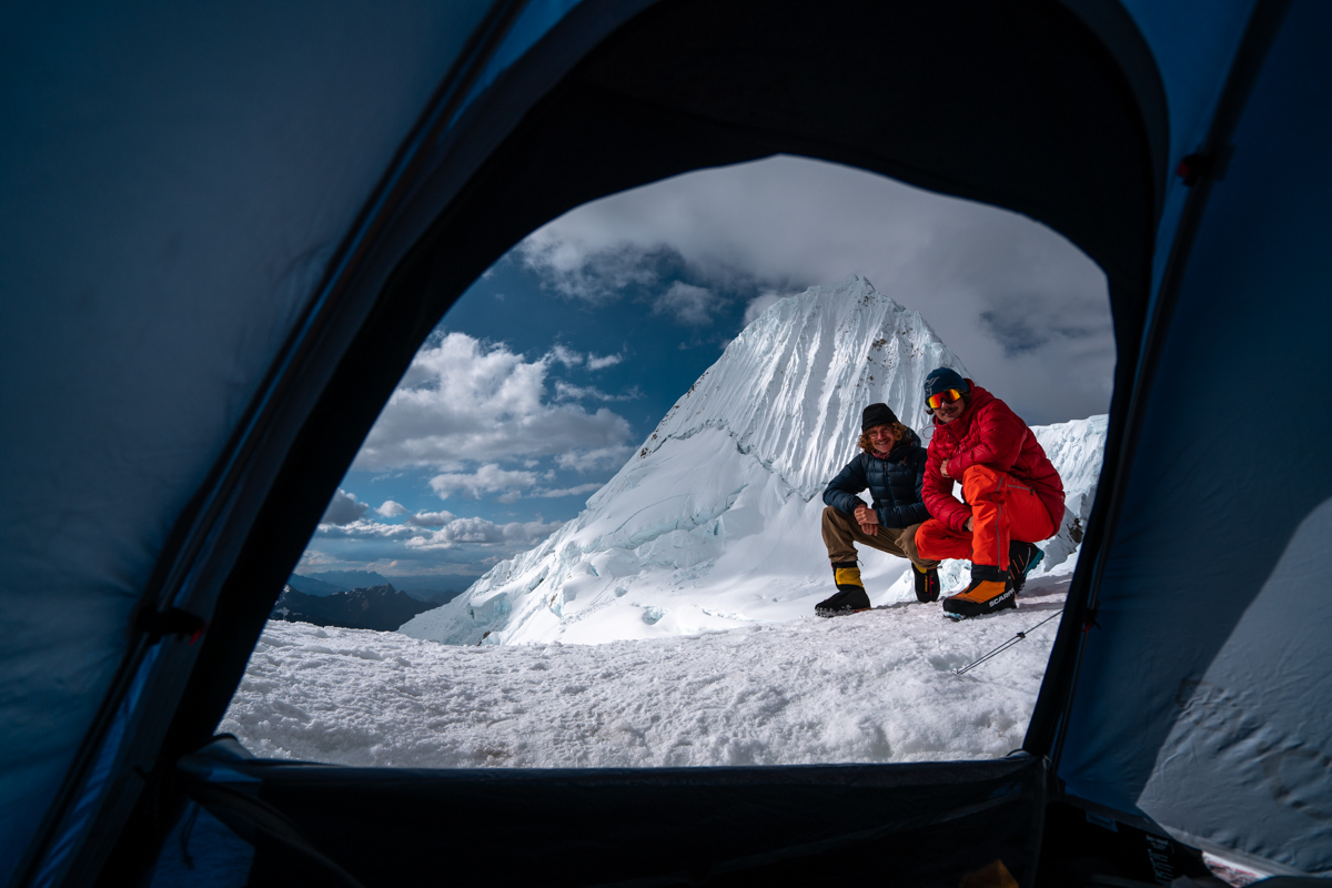
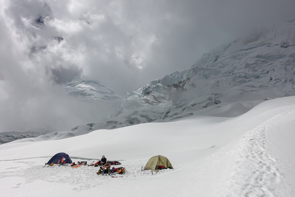
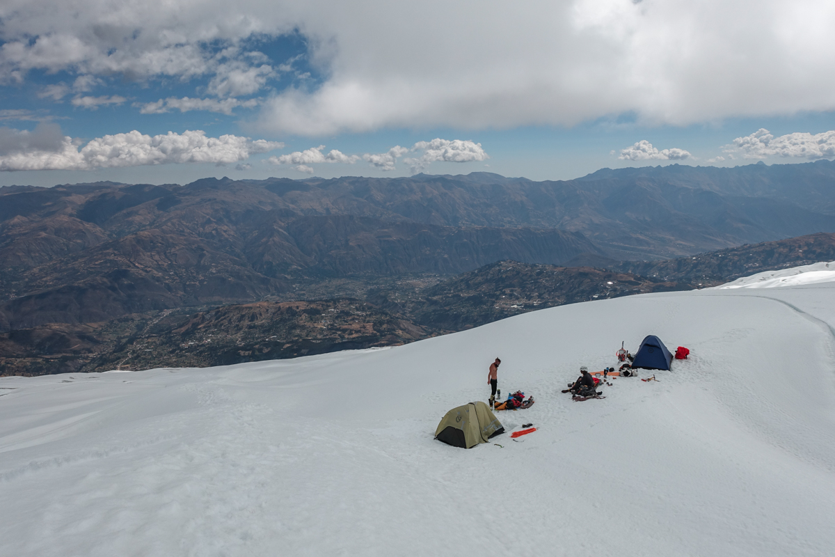
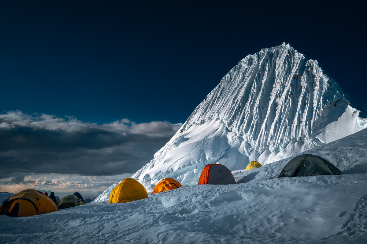
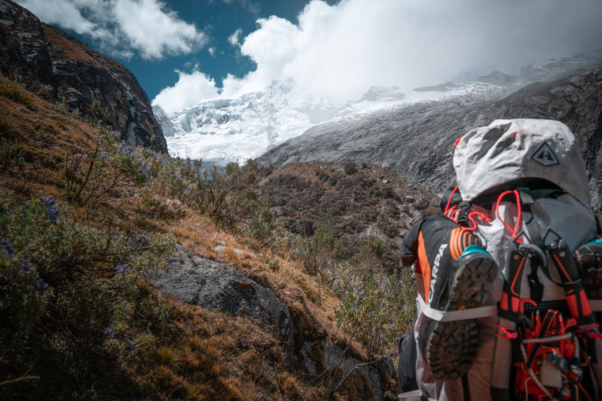
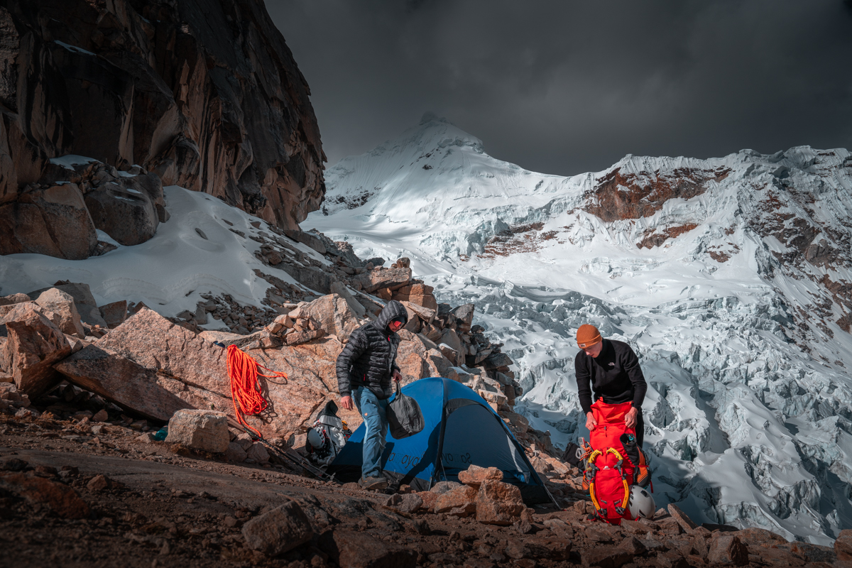
After getting some sleep, we packed up and descended back to base camp. There, we met Benni and Luca, who were just heading up to Tocllaraju High Camp to attempt the summit via the normal route the following day. We, on the other hand, did absolutely nothing the next day. I was lying on my sleeping mat in front of the tent all day, enjoying the sun and were simply happy about being where I was. In the afternoon, Luca and Benni returned to base camp as well. They also reached the summit.

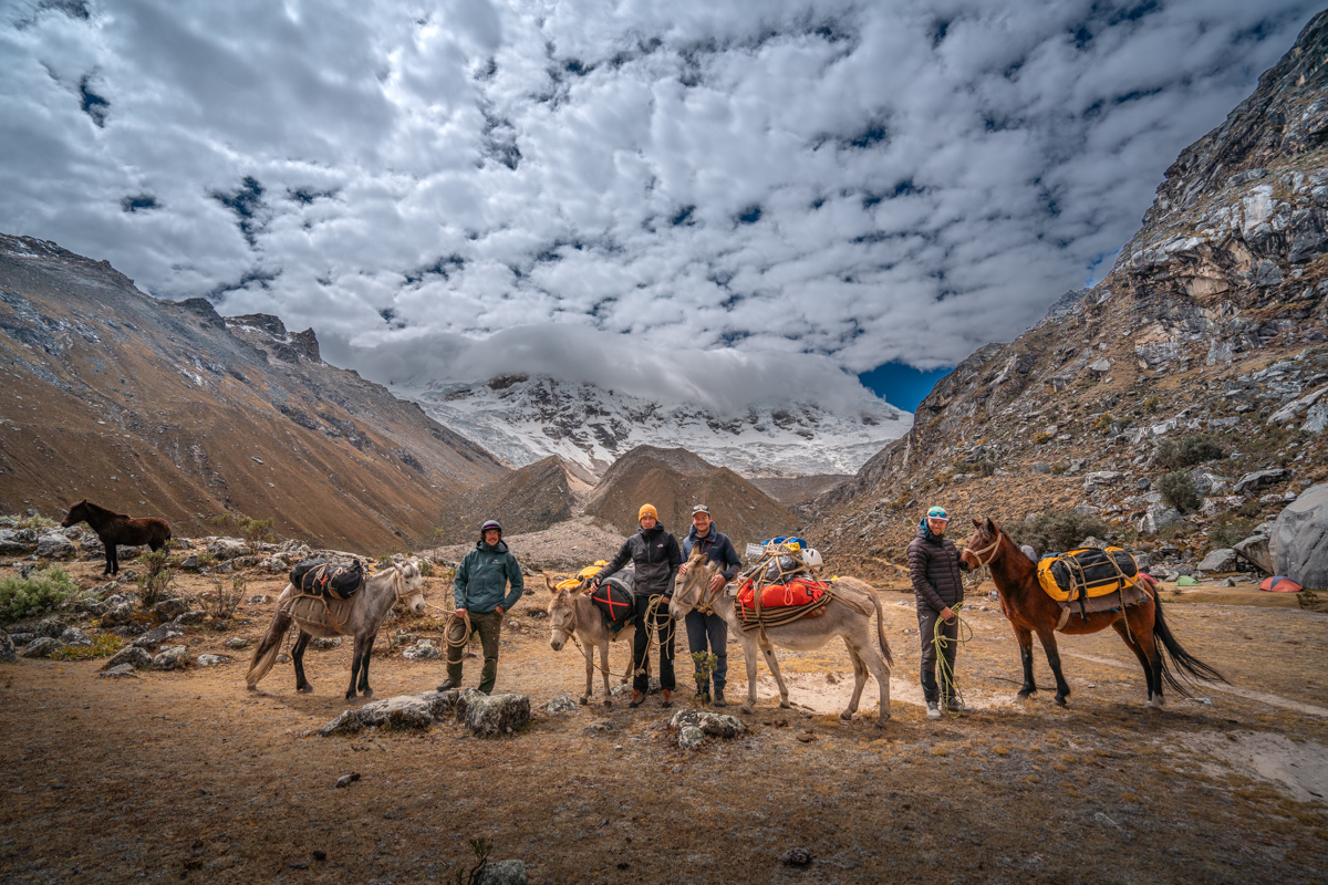
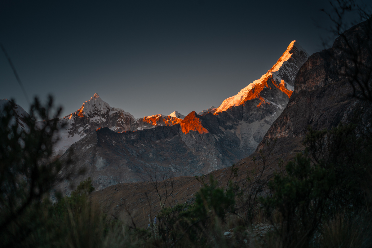
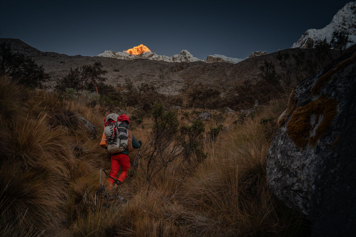
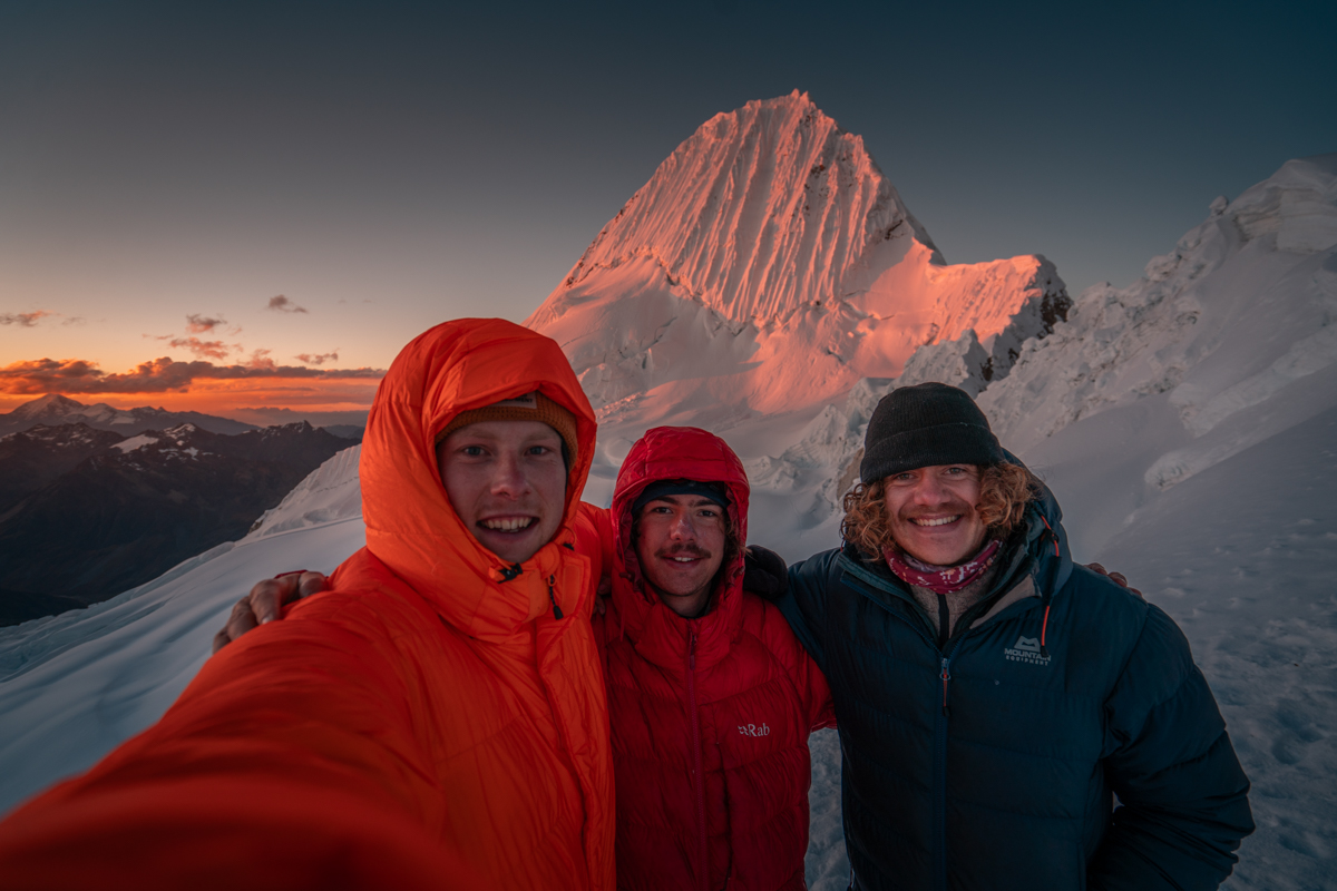
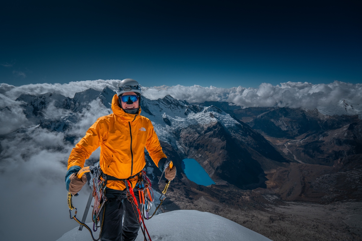
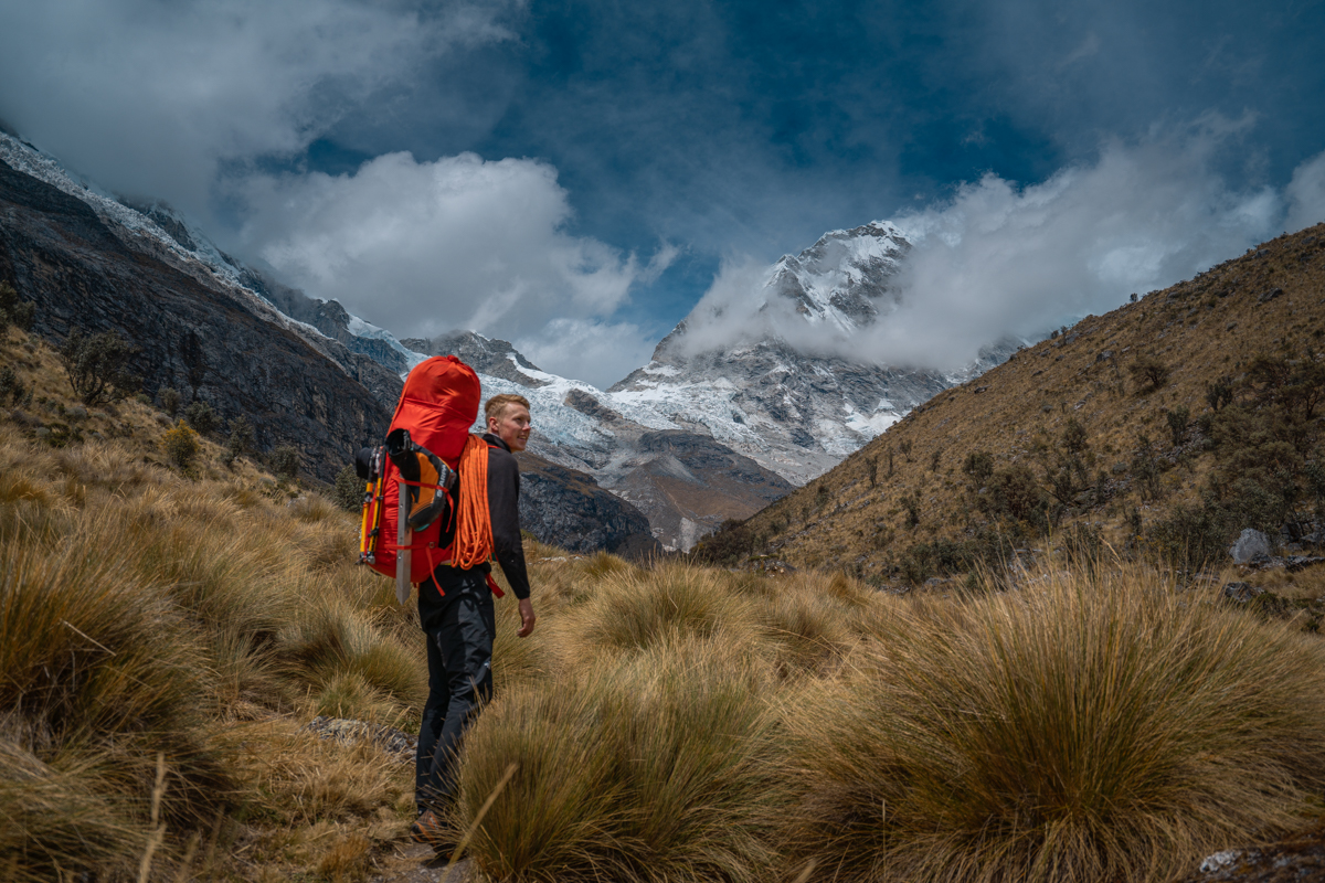
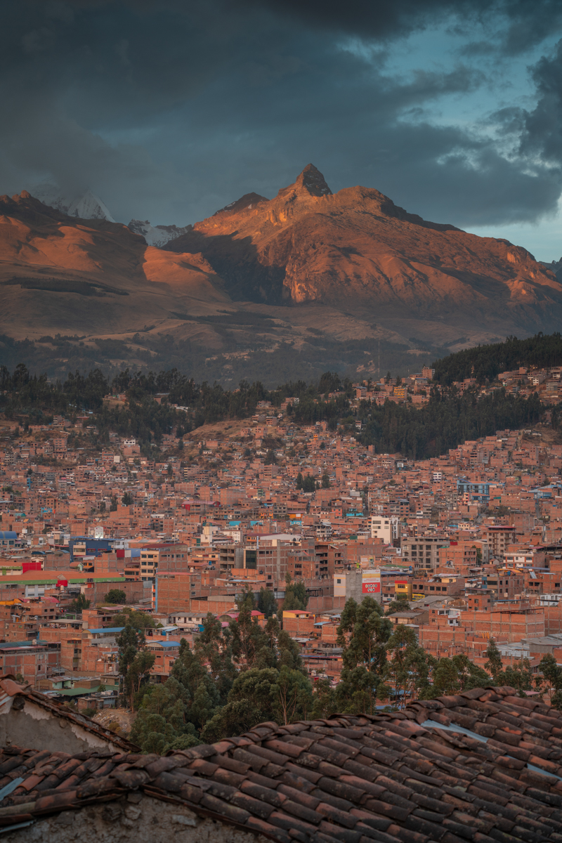
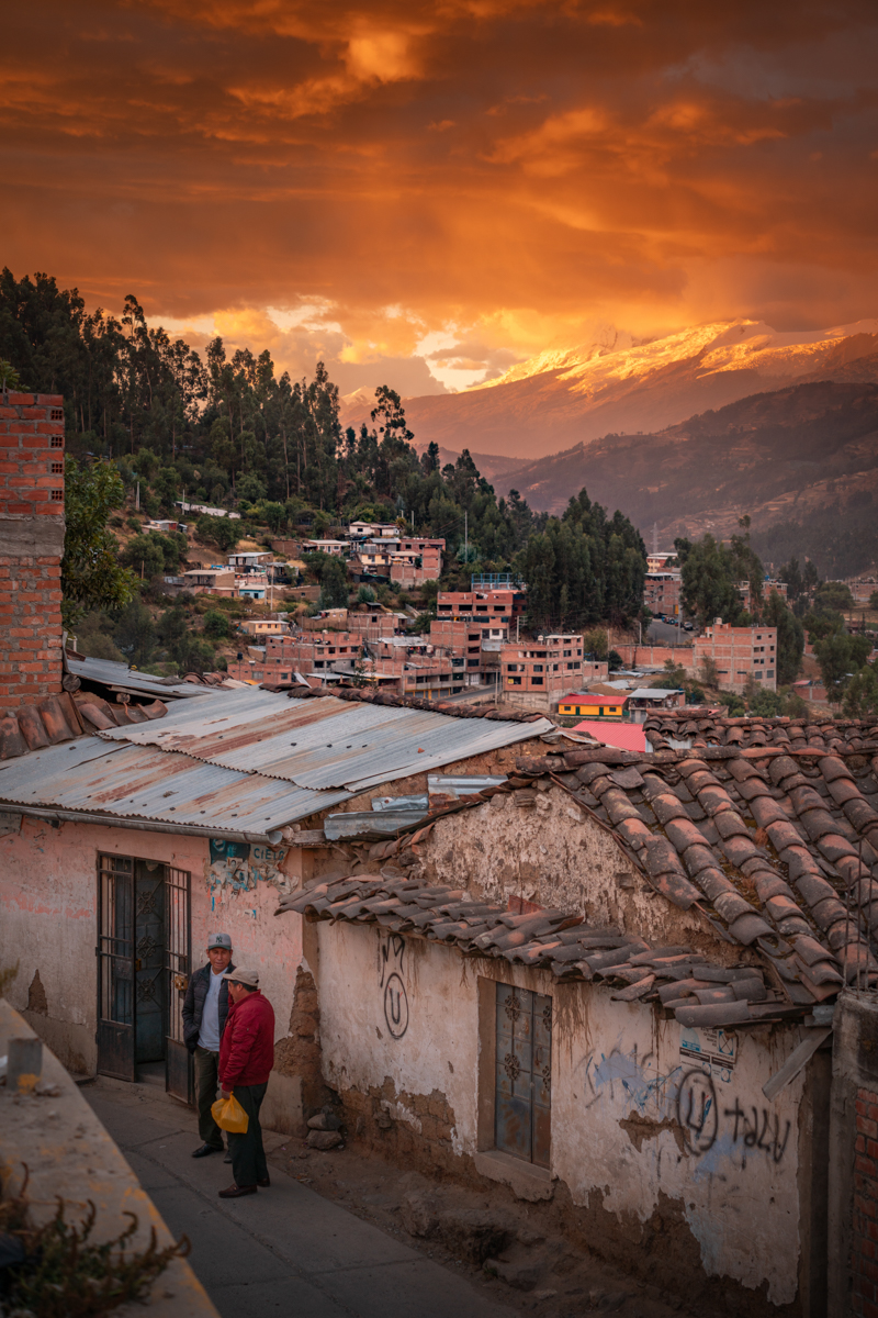
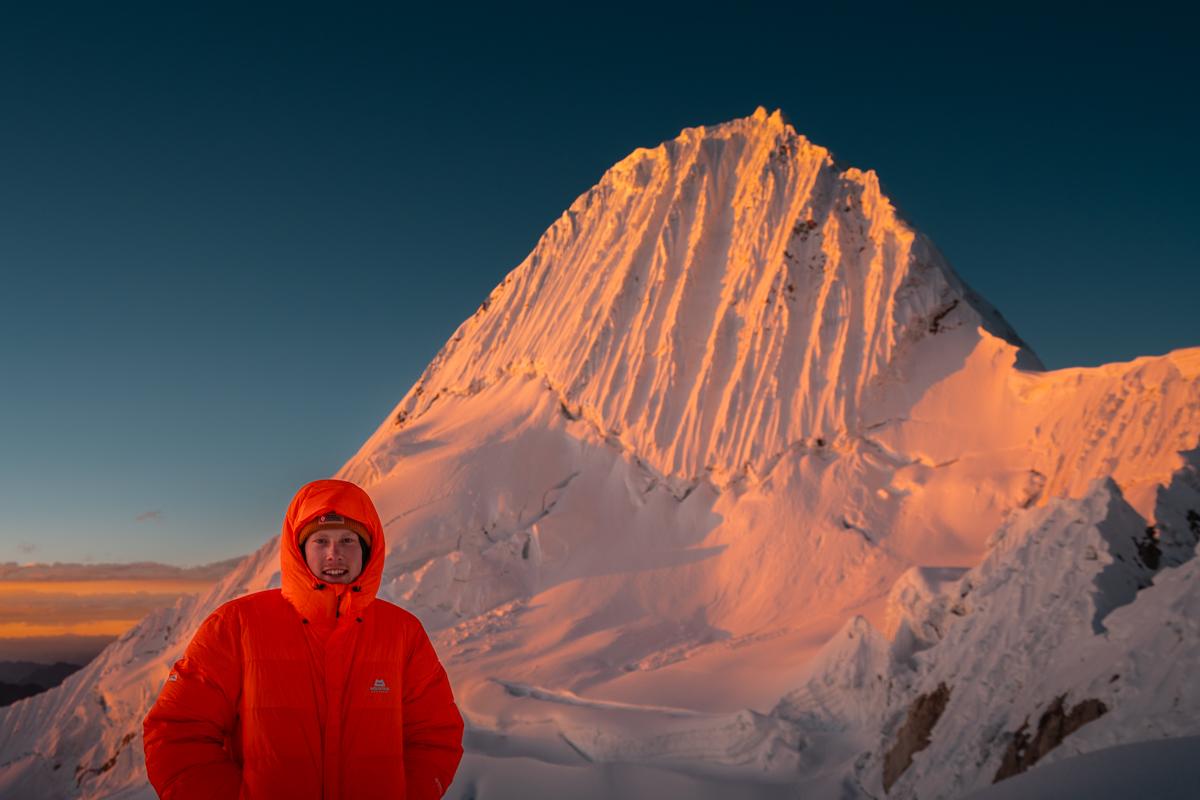
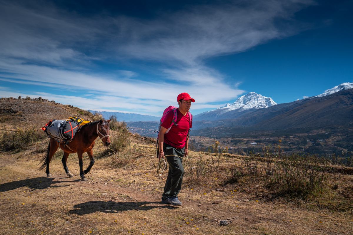
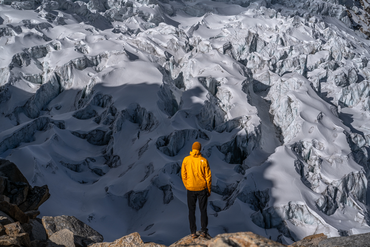
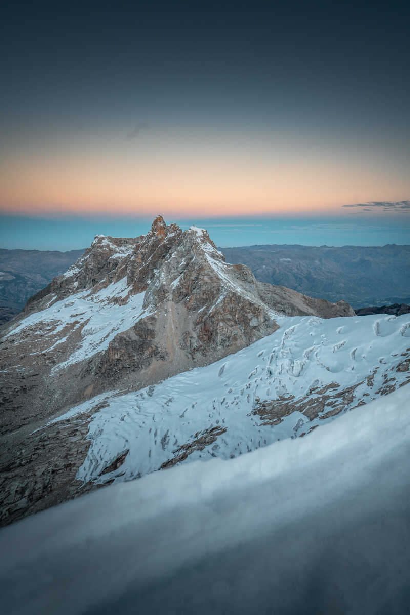
The next day, Cirilo was scheduled to come back up to Basecamp with his donkeys and horses. However, I felt that before leaving the Ishinca Valley, I wanted to do one more climb. So I set my alarm for 3:30 a.m. to quickly ascend Nevado Urus Este and watch the sunrise from up there. No one else was motivated, so at 3:45 a.m., I left base camp alone. About 1,000 vertical meters lay ahead. For a long part oft he way, I climbed steeply over scree and easy scrambling terrain, then crossed a small glacier and continued with the first daylight climbing and scrambling to the summit at 5,423 meters, which I reached after 2.5 hours. The sunrise was unfortunately a bit cloudy, but it was still a beautiful and peaceful moment to sit alone on a summit in the middle of such a spectacular landscape. The descent was quick, and after a total of four hours, I was back at the tent — a perfect morning. After breakfast (Benni cooked porridge for everyone) Cirilo arrived, and we made our way back to Pashpa and from there by car to Huaraz.

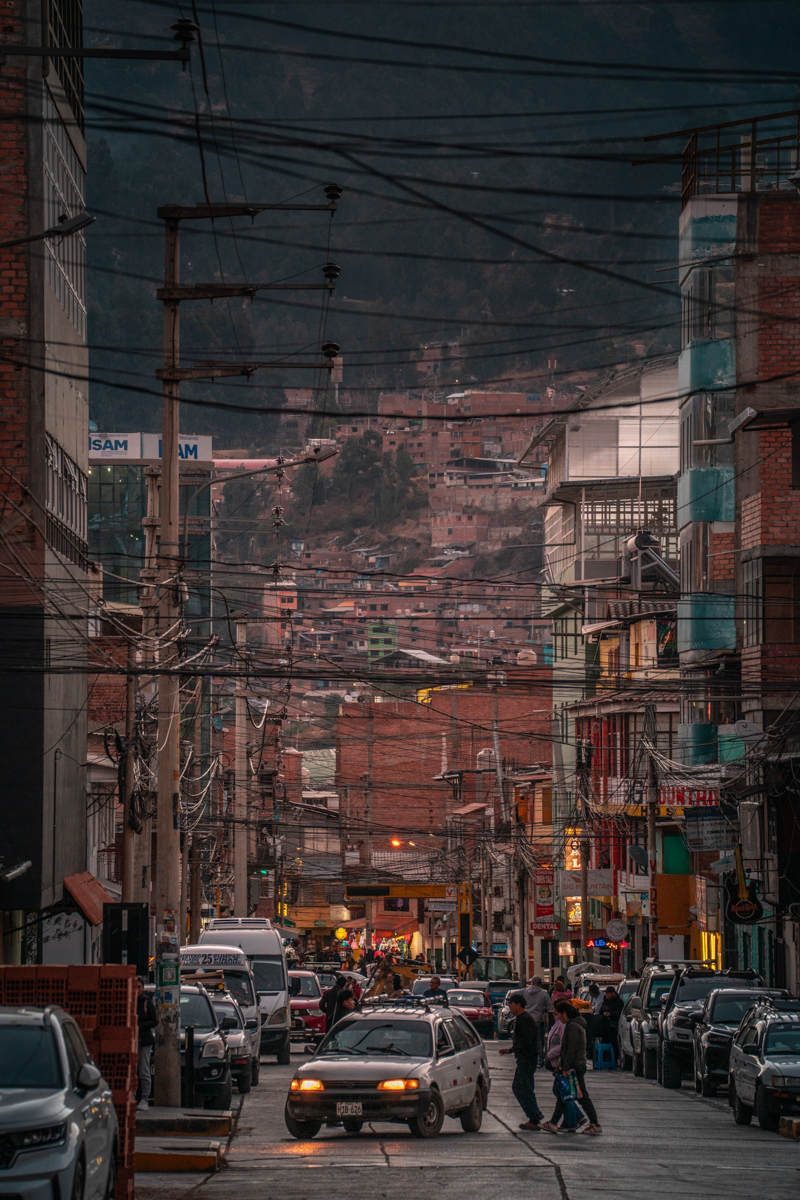
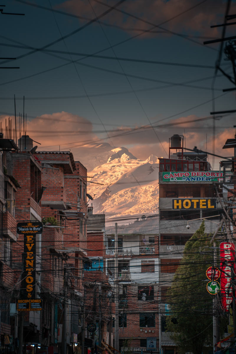
Back in Huaraz, another surprise awaited us. A large local festival was taking place, and all rooms in town were completely booked. We had given up our room during our time in the Ishinca Valley, and now everything was full. Arti offered us a solution: we could sleep in the top floor. There was a large bouldering wall, and the four of us slept on crash pads on the floor beneath it. A funny finish oft he Ishinca Trip. From the next day on, we had proper beds again.

Days 22–30

For the next few days, the weather forecast in the Cordillera Blanca looked not really good, and we weren’t quite sure what to do. One evening, a larger group of us were sitting together in the hostel when Ben, a German we had met a few days earlier, came up the stairs and said, “Good weather is forecast for Alpamayo on Sunday!”

We checked the forecast ourselves, and indeed, sunny weather was predicted for Sunday. Ben asked if he could join us in case we decided to go to Alpamayo, which we happily agreed to. At the same moment, Joost came up the stairs as well and said he was in too — perfect, as that would allow us to form two rope teams of two. Still, we remained cautious. It was only Monday, and we knew how unreliable the weather forecast could be here in the high mountains. We decided to wait two more days before making a final decision to see how things developed. In the meantime, we spent the evening at the local festival, which was an experience in itself.

The nex day was special one for me. After our usual grocery run at the Mercado Central, Luca, Benni, Luca, and I went to the Barrio Los Olivos, a neighborhood a bit higher up above the city. Four years earlier, that was where I had climbed for the first time ever in my life. To be back there now, climbing again at this exact same place with incredible views over Huaraz and the glaciers, felt amazing.

By Wednesday, the forecast for Sunday still looked good, and so we decided to set off towards Alpamayo the following day. Once again, the big packing session began. Our rrom was a mess since four people tried to organise all their climbing gear. We restocked supplies, and Cirilo gave me the number of a friend of his who lived in Cashapampa, the mountain village from where we would start our approach. I arranged by phone that we could have three donkeys the next day.

Detailed report about Alpamayo & Quitaraju can be found here.

Early the following morning, we took a colectivo (minibus) to Caraz. There, we had to carry our luggage halfway across town before finding another colectivo that finally brought us up to Cashapampa at around 2,900 meters. There we met Arnuljo, our arriero (donkey driver). Together, we headed into the Santa Cruz Valley. I already knew this valley from my first stay in Peru, when I did the Santa Cruz Trek. It was during that trip that the dream of climbing Alpamayo was born. Being back here a few years later for exactly that reason felt surreal.

We took the approach to Alpamayo Base Camp at an easy pace. We still had time before the good weather window would arrive, so we conserved our energy. Over two days, we hiked through beautiful landscapes to base camp.

After a short night at base camp, we set off just before sunrise towards high camp. Our backpacks were, as usual, very heavy, and the more than 1,000 meters of elevation gain made the ascent exhausting. At 5,000 meters, we reached the glacier, and shortly afterwards it became steep as we had to climb through an icefall. In the final section, we even had to belay properly as we cllimbed through a narrow, steep ice gully in the glacier. Then we had made it and I could hardly believe that I was suddenly standing in Alpamayo High Camp at around 5,450 meters, a place I had seen so many times in pictures. A truly special moment.

Later that day, the weather improved, and we were rewarded with a phenomenal sunset that bathed the entire Southwest Face in glowing orange light. A beautiful sight.

Unfortunately, I couldn’t sleep at all that night. I’m not sure whether it was the altitude, the excitement, or a mix of both. At midnight, the alarm rang, and I was almost relieved that I no longer had to try to fall asleep. It took a bit longer than I liked until everyone was ready, but then we began the approach to the South-West Face. A few other rope teams were ahead of us, which caused a small traffic jam at the bergschrund.

Once we were finally in the face, we found perfect conditions in the French Direct Route. We made quick progress, overtook a few teams, and were truly able to enjoy the climbing. When the sun rose and we could finally see where we were, everything became even better. After a few hours of magnificent climbing, I reached the top of the face and stepped onto the ridge leading to the summit. It was another emotional moment when I finally stood on the summit of Alpamayo at 5,947 meters. We spent about 20 cold minutes on the summit (alone, with no other rope team there) before beginning our rappels.

Shortly after noon, we were back at high camp and finally able to eat something. We started discussing what to do the next day. Should we attempt Quitaraju, a 6,000-meter peak on the other side of high camp, via its North Face? Or should we sleep in and descend to base camp? The past few days had already been long and exhausting, and Joost decided not to go for Quitaraju. Luca, Ben, and I agreed to decide spontaneously during the night.

Once again, I barely slept. I’m certain I didn’t sleep at all before 10 p.m., and in the last two hours before the alarm rang at midnight, I’m not even sure if I managed to drift off. Luca decided to stay in the tent, but Ben and I chose to give Quitaraju a try. So we got up once more and set off.

First, we had to cross a large glacial basin to reach the North Face. At the beginning, I didn’t feel particularly strong, but once we had crossed the bergschrund and were in the face, I suddenly felt a surge of energy and began to feel much better. Unlike on Tocllaraju and Alpamayo, we climbed simultaneously, as conditions were once again excellent and the North Face was not as steep as the previous walls we had climbed.

By first daylight, we had already completed most of the route, and the sunrise that followed was simply spectacular. We were above the clouds with an incredible view to Alpamayo and the route we had climbed the day before. It was undoubtedly the most beautiful sunrise of the entire expedition.

The remaining section of the North Face became gradually less steep and easier to climb. We reached a spectacular, broad ridge that led us to the summit at 6,036 meters. A few hours earlier, I had genuinely doubted whether I would make it up there — which made standing on the summit even more rewarding.

The descent turned out to be quite challenging. We wanted to rappel down our ascent route, but in the upper section, we struggled to build a solid anchor. After several attempts, we managed to place a snow anchor and rappel from it — thankfully, it worked well. Lower down, we found better ice and could build V threads and rappell from these.

Back in the large glacial basin, we sat down in the snow for a short rest before returning to high camp. There, Ben and I shared a portion of rice before packing up camp and beginning the long descent to base camp, which we finally reached in the dark. Just like on Tocllaraju, Ben and I had spent 19 hours on the mountain that day. That evening, we celebrated with a proper serving of pasta.

The next day, 24 kilometers of trekking lay ahead of us to return to Cashapampa. Fortunately, Arnuljo’s donkeys once again helped with the heavy gear, making the hike much easier. When we arrived in Cashapampa in the evening, there were unfortunately no colectivos left heading back down the valley. To be honest, I don’t even remember (or maybe I never really knew) how we got back to Huaraz that night. Someone gave us a ride down the valley and “handed us over” to someone else — I have no idea where he came from — and with him, we finally managed to return to Huaraz.

Days 31–36

The following days weren’t particularly pleasant for me. On the second night after returning from Alpamayo, I got food poisoning. For the next few days, I was completely out of action. I barely ate and mostly just lay in bed.

After a few days, Luca, Ben, Honza (a Czech climber we had met in Huaraz) and I sat down together at Café Andino to plan our next objective. We wanted to attempt Huascarán, the highest mountain in Peru. We had chosen the Shield Route, which leads through a several hundred meters high ice wall before reaching the summit ridge.

Unfortunately, the glacier on Huascarán has changed dramatically in recent years, making an ascent very dangerous. The normal route, for example, no longer exists, which has significantly reduced the number of successful climbs. Local mountain guides told us that no one had reached the summit the previous year. However, this season five teams had apparently summited via an alternative variation of the normal route. We also knew of a Japanese team that had climbed the Shield Route earlier in the season but their attempt that tragically ended with the death of one of the two Japanese climbers. Despite all this, we wanted to see the situation for ourselves and possibly make an attempt. So we began preparing to leave within the next few days.

Days 37–39

On day 37 of our expedition in the Cordillera Blanca, the four of us finally set off for Huascarán. I was curious to see how I would feel, as I still didn’t feel completely strong after the food poisoning. Honza, who has been living in Peru for several years, had a car, and we drove to the small village of Musho at the foot of Huascarán.

There, a few donkeys were waiting to carry parts of our equipment to base camp, which lies about 1,200 meters above Musho. However, we didn’t stay at base camp. Instead, we continued the ascent now with heavy backpacks up to Refugio Huascarán. After a total of 1,600 meters of elevation gain, we reached the hut. Two Peruvians were there managing it, but otherwise it was empty. They seemed somewhat surprised to see us. They told us that since the glacier had become so dangerous, hardly any climbers had been coming up. We allowed ourselves the luxury of spending a night in the refuge. That way, we could set off more quickly the next morning and wouldn’t have to pack up wet tents.

Our goal for the following day was to build up a high camp on the glacier at around 5,300 meters. The ascent was strenuous with the heavy packs and a steady incline. Fortunately, the weather was good. In the area where we hoped to camp, we found a relatively flat spot between two small crevasses. We began digging platforms for our tents and setting up camp.

It felt special to be completely alone on the mountain, having to figure everything out ourselves. From our camp, we had a clear view of “The Shield,” the massive ice wall towering above us. What worried us, was a large icefall lying between us and the wall. Apart from the Japanese team at the very beginning of the season, local guides said that no one had found a way through this icefall all year.

We planned to wake up at 10 p.m. to start our summit push one hour before midnight. But when the alarm rang, we immediately realized we would have to reconsider. Outside, there was a whiteout, heavy snowfall and unusually warm temperatures. We shouted back and forth between the tents, discussing what to do, and decided to wait another hour.

After that hour, the weather hadn’t improved, but we told ourselves that if we didn’t start now, it would be too late. So we set off, hoping conditions would improve once we reached the icefall. Unfortunately, that wasn’t the case. We entered the icefall in heavy snowfall, with almost no visibility or orientation.

After some time, we found ourselves standing on a large block of ice, surrounded by impassable crevasses. It quickly became clear that we couldn’t continue this way. So we descended and tried again at another spot but also without success. At one point, we heard ice collapsing somewhere within the icefall, which was far from reassuring.

After two and a half hours of searching for a way through, we gave up. We had already lost a lot of time, and most of the route (about 1,300 vertical meters) still lay ahead. More importantly, the risk of spending more time in the icefall felt too high to me. So we turned around and were at least able to get some more sleep.

When it became light again, we gathered outside the tents to reassess. Once more, we used the drone to look for a route. The best option Ben identified would have required us to rappel from seracs during the ascent and pass through a zone clearly threatened by icefall. Honza immediately said he didn’t want to try again, and I fully agreed. Ben was determined to give it another attempt, while Luca was undecided.

We had a long discussion. I explained that, for me, it didn’t make sense to take such a high risk (especially with the just small chance of success) and spend even more time in that icefall. From our camp, we repeatedly saw large chunks of ice breaking off, which only reinforced my concerns. In the end, Honza and I descended back to the refuge, and Ben and Luca followed shortly afterwards. Even though it was a difficult decision ( had really wanted to climb that route) I was very happy with it. It felt like we had made the right call.

From the refuge, we continued descending all the way back to Musho the same day, meaning we covered nearly 2,500 meters of descent. It turned into another long, exhausting, but also beautiful day.

Days 40–43

Besides Alpamayo and Huascarán, there was one more mountain I already knew before the expedition that I really wanted to try to climb: Shaqsha Sur. It’s a (compared to some of the other mountains in the region) relatively unknown peak in the southern part of the Cordillera Blanca.

After returning from Huascarán, we allowed ourselves two rest days. Then Luca, Ben, and I set off. Honza gave us the contact of a Peruvian who drove us from Huaraz via Olleros onto a grassy high plateau. From there, we started on foot. There wasn’t really a trail and we made our own way through a hilly grassland unlike anything I’d seen elsewhere in the Cordillera Blanca. Soon, we caught our first glimpse of Shaqsha Sur, which made orientation much easier. At around 4,600 meters, we set up camp. The weather was very changeable that day. Sunshine, snow, hail, and thunderstorms. Because of this we spent most of the time inside the tent after setting up camp and went to sleep early.

Detailed report about Shaqsha Sur can be found here.

The next day, we started again in the middle of the night. Luca stayed in the tent, feeling unwell, so only Ben and I headed towards Shaqsha Sur. We quickly reached a broad ridge, which we followed for quite a while without gaining much height. At a rock tower, we left the ridge to the left and descended to the glacier. Afterwards, this proved to be a mistake, as progress on the glacier was slow and we had to carefully climb steep rock slabs without protection, in order to come back tot he route. Ben then had to take a forced break, and I thought we might have to abandon the climb. But after a while, he recovered, and we continued.

Through a traverse on steep ice, we reached a flatter section of the glacier and were back on the route. The detour had cost us time, and by the time we reached stood below the impressive South-East Face, the sun was rising. We climbed past a few large crevasses to reach the bergschrund. I tried to cross on a snow bridge, but it collapsed under me. Fortunately, the broken piece jammed in the crevasse, and nothing happened. We decided to take another detour, crossing the bergschrund further to the right, which worked, and we finally stood in the South-East Face.

The conditions were poor. Deep, loose, and steep snow made progress very slow. Occasionally, there were better sections, but overall, we moved slowly. We climbed simultaneously, with me leading the face. In the upper section, patches of bare ice appeared, which was useful for placing ice screws for ptotection. Just below the summit, we had to cross three very steep ice steps. Then we stood on the summit at nearly 5,700 meters — or at least just below it. The actual summit was only a few meters away, but between it, and the sub-summit we were on, was an almost vertical, completely flat rock wall that we couldn’t climb. Since we were already running late, we decided to rappel and return to camp. On the descent, we even found the actual route and were much faster.

Again, we didn’t stay another night at camp. At sunset, we broke down the camp and hiked back in the dark through the grasslands toward the little „street“ to Olleros, where our driver picked us up.

Days 44–51

After returning from Shaqsha Sur, I began to feel that I was a bit out of energy. After six weeks, multiple summits, and many long days at high altitude, I realized I needed a longer break. I still had two weeks left in Peru but decided I only wanted to attempt one more summit before calling it a season. Luca felt the same way, so on day 47, we set off for Chopicalqui — a 6,000-meter peak that isn’t technically very difficult but lies beautifully next to Huascarán. I thought it would be a perfect final climb.

Detailed report about Chopicalqui can be found here.

We started at a bend in the road leading to the Portachuelo de Llanganuco pass. After about an hour through a lightly forested valley, we reached Chopicalqui Base Camp. Since we hadn’t done much yet that day, we continued through a spectacular landscape of massive moraines left by enormous glaciers. After about 800 meters of elevation gain, we reached Moraine Camp at 5,000 meters. That evening, I was in an especially good mood. I wasn’t nervous about the next day. I was just relaxed and grateful for everything I had experienced over the past few weeks. I lay on a large rock in the sun and listened to some music. I felt a little sad knowing it would be my last evening at a high camp in Peru for this year, but it was a positive, reflective kind of sadness.

That night, the weather was again not really good as we set off. After barely 100 meters, Luca wasn’t feeling well and returned to camp. We hadn’t reached the glacier yet, and he was okay with me continuing alone. I wasn’t sure if I would make it to the summit by myself, but I didn’t want to turn back yet. So I searched through dense fog for a way onto the glacier, which I reached just a few minutes later. Being completely alone on such a large glacier at night was an intense experience

I should note that Chopicalqui is a well-traveled mountain, and I could follow a beaten track. This helped with orientation and indicated where crossing points for crevasses might be the safest. The weather didn’t improve much by sunrise. It remained gray and cloudy. After an imposing crevasse zone, I reached a long, flat slope that seemed endless. Eventually, I overcame it and suddenly stood at 6,000 meters. Here, it became steep, and I had to use both ice tools to climb. About three rope lengths of approximately 50° followed, but the snow conditions were good, so it wasn’t a problem.

Shortly after that I reached the famous and impressive summit serac. The high altitude made progress tiring, especially as the slope steepened. The highlight came around 6,300 meters. I had to traverse the serac to reach the summit slope — over a thousand meters of exposure beneath me — and climbed above the clouds to the summit. A spectacular moment. At 6,354 meters, the weather finally improved. The sun came out, and I had a breathtaking view of the Cordillera Blanca peaks.

Since I was alone and still had a long way down, I didn’t stay long on the summit. I began rappelling three or four times until I reached flatter terrain and could continue descending on foot. Aside from a few crevasses to cross, there were no further difficulties. When I reached the end of the glacier, I had one more emotional moment, realizing this was my last climb in Peru for the year. I was indescribably happy with what we had accomplished and grateful that nothing had gone wrong.

When I reached camp, Luca was already gone, having descended ahead. I packed up and started descending back to the road as well. There, I met Luca again, and we tried to hitchhike the nearest town. After about two hours, we were picked up by a Peruvian family who drove us to Yungay, from where we took a colectivo back to Huaraz.

That was the final mountain tour of the season. We then had three more days in Huaraz and during that time, I often returned to the Mercado Central and other places that had become my temporary home over the past weeks. On the last evening, I took a tuk-tuk back to Barrio Los Olivos to watch one final beautiful sunset above the city. We also said goodbye to Arti before boarding the night bus to Lima. An incredibly eventful and beautiful time had come to an end, and when the bus left Huaraz I already hoped to return as soon as possible. Even six months later, as I write this, I can hardly wait to walk the streets of Huaraz again.